Difference between revisions of "2010-08-27 37 -88"
From Geohashing
imported>SporkOnABike ([live picture] not flip-flop terrain [http://www.openstreetmap.org/?lat=37.0882158&lon=-88.60212296666667&zoom=16&layers=B000FTF @37.0882,-88.6021]) |
imported>SporkOnABike ([live picture] this is the 'road' we were supposed to tirn on. [http://www.openstreetmap.org/?lat=37.0882158&lon=-88.60212296666667&zoom=16&layers=B000FTF @37.0882,-88.6021]) |
||
| Line 39: | Line 39: | ||
Image:2010-08-27_37_-88_22-30-14-014.jpg | not flip-flop terrain [http://www.openstreetmap.org/?lat=37.0882158&lon=-88.60212296666667&zoom=16&layers=B000FTF @37.0882,-88.6021] | Image:2010-08-27_37_-88_22-30-14-014.jpg | not flip-flop terrain [http://www.openstreetmap.org/?lat=37.0882158&lon=-88.60212296666667&zoom=16&layers=B000FTF @37.0882,-88.6021] | ||
| + | |||
| + | Image:2010-08-27_37_-88_22-31-12-693.jpg | this is the 'road' we were supposed to tirn on. [http://www.openstreetmap.org/?lat=37.0882158&lon=-88.60212296666667&zoom=16&layers=B000FTF @37.0882,-88.6021] | ||
</gallery> | </gallery> | ||
Revision as of 03:31, 28 August 2010
| Fri 27 Aug 2010 in 37,-88: 37.1153495, -88.7117253 geohashing.info google osm bing/os kml crox |
Location
Participants
Plans
Expedition
Tracklog
Photos
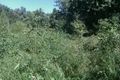
not flip-flop terrain @37.0882,-88.6021

this is the 'road' we were supposed to tirn on. @37.0882,-88.6021


Achievements