Difference between revisions of "2010-11-25 49 -123"
From Geohashing
imported>Thepiguy (Fini) |
imported>Thepiguy m |
||
| Line 6: | Line 6: | ||
== Location == | == Location == | ||
| − | Richmond... kinda' sorta' | + | Richmond... kinda' sorta'. |
== Participants == | == Participants == | ||
| Line 19: | Line 19: | ||
== Photos == | == Photos == | ||
<gallery> | <gallery> | ||
| + | Image:2010-11-25_49_-123_snow.JPG|The dike. | ||
Image:2010-11-25_49_-123_gps.JPG|As expected. | Image:2010-11-25_49_-123_gps.JPG|As expected. | ||
| − | |||
Image:2010-11-25_49_-123_there.JPG|That way. | Image:2010-11-25_49_-123_there.JPG|That way. | ||
Image:2010-11-25_49_-123_sign.JPG|A little bit funny. | Image:2010-11-25_49_-123_sign.JPG|A little bit funny. | ||
Revision as of 02:25, 21 December 2010
| Thu 25 Nov 2010 in 49,-123: 49.1533829, -123.2176960 geohashing.info google osm bing/os kml crox |
Contents
Location
Richmond... kinda' sorta'.
Participants
Plans
About 1km off shore of Richmond's west dike. Inaccessible without some sort of amphibious vehicle.
Expedition
It was snowing. I had new boots. Why not go for a walk?
Photos
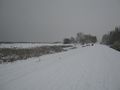
The dike.
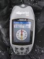
As expected.
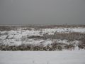
That way.
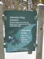
A little bit funny.


