Difference between revisions of "2011-12-22 43 -88"
imported>RocketMac (→Participants) |
imported>FippeBot m (Location) |
||
| (3 intermediate revisions by 2 users not shown) | |||
| Line 1: | Line 1: | ||
| − | |||
| − | |||
| − | |||
| − | |||
| − | |||
| − | |||
| − | |||
| − | |||
| − | |||
| − | |||
{{meetup graticule | {{meetup graticule | ||
| lat=43 | | lat=43 | ||
| Line 15: | Line 5: | ||
}} | }} | ||
| − | + | ||
| − | |||
== Location == | == Location == | ||
| − | |||
What turned out to be farmland on private property | What turned out to be farmland on private property | ||
== Participants == | == Participants == | ||
| − | |||
*[[User:RocketMac|RocketMac]] | *[[User:RocketMac|RocketMac]] | ||
*[[User:jonevk|Jon]] - That's his geocaching handle, so I'm sure he'd use it here. | *[[User:jonevk|Jon]] - That's his geocaching handle, so I'm sure he'd use it here. | ||
== Plans == | == Plans == | ||
| − | + | My web script sent me an email this morning letting me know that the hashpoint was two miles from work. Google Maps looked good, and I was itching for a [[Consecutive_geohash_achievement|Consecutive Geohash Achievement]] so I started formulating plans on how to ask for access to private property, when I could leave work, etc. | |
| + | |||
| + | Around lunchtime Jon, a geocaching co-worker suggested a coffee run which would put us near the point. I mentioned it and he agreed! | ||
== Expedition == | == Expedition == | ||
| − | |||
| − | + | The drive to the spot was fine. We drove by a house Jon had seen for sale, but driving past it was clear it needed work. On to the hashpoint! | |
| − | + | ||
| + | Google Maps had suggested that it was in the front yard of the house, so pulling up seeing cars in the driveway, I was considering knocking and asking for permission. When I punched it into my GPS app, it appeared in a large plot of land behind the house with no public access. Jon looked at the map and thought he found a walking approach though we would be trespassing which I wasn't keen on doing. It was also over a quarter mile away, and we should be getting back. | ||
| + | |||
| + | After a brief discussion, we agreed to abort and head back. *sigh* | ||
| + | |||
== Photos == | == Photos == | ||
| − | |||
| − | |||
| − | |||
<gallery perrow="5"> | <gallery perrow="5"> | ||
| + | Image:2011-12-22_43_-88_01.jpg | D'oh! | ||
</gallery> | </gallery> | ||
| Line 45: | Line 35: | ||
{{#vardefine:ribbonwidth|800px}} | {{#vardefine:ribbonwidth|800px}} | ||
<!-- Add any achievement ribbons you earned below, or remove this section --> | <!-- Add any achievement ribbons you earned below, or remove this section --> | ||
| + | {{No trespassing | ||
| + | | latitude = 43 | ||
| + | | longitude = -88 | ||
| + | | date = 2011-12-22 | ||
| + | | name = RocketMac | ||
| + | | image = | ||
| + | }} | ||
| + | {{drag-along | ||
| + | | latitude = 43 | ||
| + | | longitude = -88 | ||
| + | | date = 2011-12-22 | ||
| + | | partner = jonevk | ||
| + | | name = RocketMac | ||
| + | | image = | ||
| + | }} | ||
| − | |||
| − | |||
| − | |||
| − | |||
| − | |||
| − | |||
| − | |||
| − | |||
| − | |||
| − | |||
| − | |||
[[Category:Expeditions]] | [[Category:Expeditions]] | ||
| − | |||
| − | |||
| − | |||
| − | |||
| − | |||
| − | |||
| − | |||
| − | |||
| − | |||
| − | |||
| − | |||
[[Category:Coordinates not reached]] | [[Category:Coordinates not reached]] | ||
| − | + | [[Category:Not reached - No public access]] | |
| − | + | {{location|US|WI|WK}} | |
| − | [[Category:Not reached - No public access]] | ||
| − | |||
| − | |||
| − | |||
Latest revision as of 01:48, 13 August 2019
| Thu 22 Dec 2011 in 43,-88: 43.0922397, -88.2487524 geohashing.info google osm bing/os kml crox |
Location
What turned out to be farmland on private property
Participants
Plans
My web script sent me an email this morning letting me know that the hashpoint was two miles from work. Google Maps looked good, and I was itching for a Consecutive Geohash Achievement so I started formulating plans on how to ask for access to private property, when I could leave work, etc.
Around lunchtime Jon, a geocaching co-worker suggested a coffee run which would put us near the point. I mentioned it and he agreed!
Expedition
The drive to the spot was fine. We drove by a house Jon had seen for sale, but driving past it was clear it needed work. On to the hashpoint!
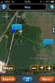
Google Maps had suggested that it was in the front yard of the house, so pulling up seeing cars in the driveway, I was considering knocking and asking for permission. When I punched it into my GPS app, it appeared in a large plot of land behind the house with no public access. Jon looked at the map and thought he found a walking approach though we would be trespassing which I wasn't keen on doing. It was also over a quarter mile away, and we should be getting back.
After a brief discussion, we agreed to abort and head back. *sigh*
Photos
D'oh!

Achievements
RocketMac earned the No trespassing consolation prize
|
RocketMac earned the Drag-along achievement
|