Difference between revisions of "2012-07-20 39 -74"
From Geohashing
imported>Mischief (→Photos) |
imported>Mischief (→Photos) |
||
| Line 41: | Line 41: | ||
Image:2012-07-20_39_-74_15-08-42-386.jpg | [http://www.openstreetmap.org/?lat=39.75439410&lon=-74.83261254&zoom=16&layers=B000FTF @39.7544,-74.8326] | Image:2012-07-20_39_-74_15-08-42-386.jpg | [http://www.openstreetmap.org/?lat=39.75439410&lon=-74.83261254&zoom=16&layers=B000FTF @39.7544,-74.8326] | ||
<gallery perrow="5"> | <gallery perrow="5"> | ||
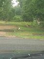
| − | Image: | + | Image:2012_07_20_Duck.jpg |
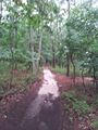
| − | Image: | + | Image:2012_07_20_Trail.jpg |
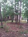
| − | Image: | + | Image:2012_07_20_Woods.jpg |
| − | Image: | + | Image:2012_07_03_Geotrash.jpg | Geotrash at the Geohash |
</gallery> | </gallery> | ||
Revision as of 15:17, 21 July 2012
| Fri 20 Jul 2012 in 39,-74: 39.7543930, -74.8327113 geohashing.info google osm bing/os kml crox |
Location
Participants
Plans
Expedition
Tracklog
Photos
- 2012 07 03 Geotrash.jpg
Geotrash at the Geohash


Achievements