Difference between revisions of "2012-07-28 47 -117"
From Geohashing
imported>Thomcat (Just off the road - aerial photo shows it on the road though. [http://www.openstreetmap.org/?lat=47.68937653&lon=-117.50480489&zoom=16&layers=B000FTF @47.6894,-117.5048]) |
imported>Thomcat ([live picture] [http://www.openstreetmap.org/?lat=47.68939589&lon=-117.50477128&zoom=16&layers=B000FTF @47.6894,-117.5048]) |
||
| Line 30: | Line 30: | ||
Image:2012-07-28_47_-117_16-03-48-097.jpg | Just off the road - aerial photo shows it on the road though. [http://www.openstreetmap.org/?lat=47.68937653&lon=-117.50480489&zoom=16&layers=B000FTF @47.6894,-117.5048] | Image:2012-07-28_47_-117_16-03-48-097.jpg | Just off the road - aerial photo shows it on the road though. [http://www.openstreetmap.org/?lat=47.68937653&lon=-117.50480489&zoom=16&layers=B000FTF @47.6894,-117.5048] | ||
| + | |||
| + | Image:2012-07-28_47_-117_16-10-12-584.jpg | [http://www.openstreetmap.org/?lat=47.68939589&lon=-117.50477128&zoom=16&layers=B000FTF @47.6894,-117.5048] | ||
</gallery> | </gallery> | ||
Revision as of 23:10, 28 July 2012
| Sat 28 Jul 2012 in 47,-117: 47.6893290, -117.5047874 geohashing.info google osm bing/os kml crox |
Location
On Indian Bluff Road, overlooking Spokane.
Participants
Plans
I plan to arrive at 4 with sidewalk chalk in hand. --Thomcat 10:13, 27 July 2012 (EDT)
Expedition
- Parked near the spot. -- Thomcat @47.6895,-117.5049 15:58, 28 July 2012 (PDT)
Tracklog
Photos
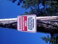
Just off the road - aerial photo shows it on the road though. @47.6894,-117.5048


Achievements