Difference between revisions of "2012-09-28 33 -117"
From Geohashing
imported>Scerruti ([live picture] The beach, or rather a think marine layer over the ocean. [http://www.openstreetmap.org/?lat=33.12617874&lon=-117.33049683&zoom=16&layers=B000FTF @33.1262,-117.3305]) |
imported>Scerruti ([live picture] Sign at entrance to field. [http://www.openstreetmap.org/?lat=33.12631264&lon=-117.33093328&zoom=16&layers=B000FTF @33.1263,-117.3309]) |
||
| Line 44: | Line 44: | ||
Image:2012-09-28_33_-117_08-56-48-745.jpg | The beach, or rather a think marine layer over the ocean. [http://www.openstreetmap.org/?lat=33.12617874&lon=-117.33049683&zoom=16&layers=B000FTF @33.1262,-117.3305] | Image:2012-09-28_33_-117_08-56-48-745.jpg | The beach, or rather a think marine layer over the ocean. [http://www.openstreetmap.org/?lat=33.12617874&lon=-117.33049683&zoom=16&layers=B000FTF @33.1262,-117.3305] | ||
| + | |||
| + | Image:2012-09-28_33_-117_08-59-02-093.jpg | Sign at entrance to field. [http://www.openstreetmap.org/?lat=33.12631264&lon=-117.33093328&zoom=16&layers=B000FTF @33.1263,-117.3309] | ||
</gallery> | </gallery> | ||
Revision as of 15:59, 28 September 2012
| Fri 28 Sep 2012 in 33,-117: 33.1261583, -117.3304991 geohashing.info google osm bing/os kml crox |
Location
Participants
Plans
Expedition
- In a field near Carlsbad State Beach. -- Stephen Cerruti @33.1261,-117.3305 11:53, 28 September 2012 (EDT)
Tracklog
Photos
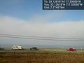
The beach, or rather a think marine layer over the ocean. @33.1262,-117.3305
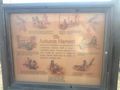
Sign at entrance to field. @33.1263,-117.3309


Achievements