Difference between revisions of "2012-10-07 55 37"
From Geohashing
imported>Vb ([http://www.openstreetmap.org/?lat=55.85960000&lon=37.56280000&zoom=16&layers=B000FTF @55.8596,37.5628]) |
imported>Vb ([live] GPS refused to behave consistently anywhere close to the building. Map showd the hash inside the building closer to the back side. Satellite - closer to the front. So I guess the corridor in the middle is good enough. Unfortunately I haven't) |
||
| Line 30: | Line 30: | ||
<!-- how it all turned out. your narrative goes here. --> | <!-- how it all turned out. your narrative goes here. --> | ||
| + | |||
| + | *GPS refused to behave consistently anywhere close to the building. Map showd the hash inside the building closer to the back side. Satellite - closer to the front. So I guess the corridor in the middle is good enough. | ||
| + | |||
| + | Unfortunately I haven't sought about bringing any geohashing objects to leave at the hash. -- [[User:Vb|vb]] [http://www.openstreetmap.org/?lat=55.83681078&lon=37.57501426&zoom=16&layers=B000FTF @55.8368,37.5750] 08:25, 7 October 2012 (EDT) | ||
== Tracklog == | == Tracklog == | ||
<!-- if your GPS device keeps a log, you may post a link here --> | <!-- if your GPS device keeps a log, you may post a link here --> | ||
Revision as of 12:25, 7 October 2012
| Sun 7 Oct 2012 in 55,37: 55.8601645, 37.5631212 geohashing.info google osm bing/os kml crox |
Location
Participants
Plans
Expedition
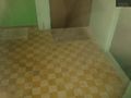
- GPS refused to behave consistently anywhere close to the building. Map showd the hash inside the building closer to the back side. Satellite - closer to the front. So I guess the corridor in the middle is good enough.
Unfortunately I haven't sought about bringing any geohashing objects to leave at the hash. -- vb @55.8368,37.5750 08:25, 7 October 2012 (EDT)
Tracklog
Photos
Reached. Kind of. @55.8596,37.5628


Achievements