Difference between revisions of "2012-10-09 32 -117"
From Geohashing
imported>Mathgeek ([live picture] Open area in the park. [http://www.openstreetmap.org/?lat=32.80674884&lon=-117.13167083&zoom=16&layers=B000FTF @32.8067,-117.1317]) |
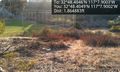
imported>Mathgeek ([live picture] Here I be. [http://www.openstreetmap.org/?lat=32.80676025&lon=-117.13167839&zoom=16&layers=B000FTF @32.8068,-117.1317]) |
||
| Line 48: | Line 48: | ||
Image:2012-10-09_32_-117_17-35-16-949.jpg | Open area in the park. [http://www.openstreetmap.org/?lat=32.80674884&lon=-117.13167083&zoom=16&layers=B000FTF @32.8067,-117.1317] | Image:2012-10-09_32_-117_17-35-16-949.jpg | Open area in the park. [http://www.openstreetmap.org/?lat=32.80674884&lon=-117.13167083&zoom=16&layers=B000FTF @32.8067,-117.1317] | ||
| + | |||
| + | Image:2012-10-09_32_-117_17-38-27-239.jpg | Here I be. [http://www.openstreetmap.org/?lat=32.80676025&lon=-117.13167839&zoom=16&layers=B000FTF @32.8068,-117.1317] | ||
</gallery> | </gallery> | ||
Revision as of 00:38, 10 October 2012
| Tue 9 Oct 2012 in 32,-117: 32.8067439, -117.1316724 geohashing.info google osm bing/os kml crox |
Location
In or around a park near Aero Dr. and Ruffin Rd.
Participants
- - Mathgeek
Plans
- This seems doable today... In or around a park near Aero Dr. and Ruffin Rd. Perhaps on my way home from work. -- Mathgeek 10:04, 9 October 2012 (PDT)
Expedition
- A lovely location in a park past the left field fence. -- Mathgeek @32.8067,-117.1317 17:31, 9 October 2012 (PDT)
Tracklog
Photos
Open area in the park. @32.8067,-117.1317

Here I be. @32.8068,-117.1317


Achievements