Difference between revisions of "2012-10-19 53 8"
From Geohashing
imported>Pah ([live picture] [http://www.openstreetmap.org/?lat=53.01981262&lon=8.10682302&zoom=16&layers=B000FTF @53.0198,8.1068]) |
imported>Pah (→Location) |
||
| Line 18: | Line 18: | ||
__NOTOC__ | __NOTOC__ | ||
== Location == | == Location == | ||
| − | + | ||
| + | A (harvested) corn field in near to [https://en.wikipedia.org/wiki/Wardenburg Wardenburg], about 10 kilometers south of [https://en.wikipedia.org/wiki/Oldenburg Oldenburg]. | ||
== Participants == | == Participants == | ||
Revision as of 18:29, 19 October 2012
| Fri 19 Oct 2012 in 53,8: 53.0198242, 8.1068597 geohashing.info google osm bing/os kml crox |
Location
A (harvested) corn field in near to Wardenburg, about 10 kilometers south of Oldenburg.
Participants
Plans
Expedition
Tracklog
Photos
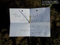
Birthday geohashing... @53.0198,8.1068


Achievements