Difference between revisions of "2012-11-24 35 -79"
imported>Birdray (Created page with "{{subst:Expedition |lat = 35) |lon = -79) |date = 2012-11-24 |image = }}") |
m |
||
| (3 intermediate revisions by 2 users not shown) | |||
| Line 1: | Line 1: | ||
| + | [[Image:{{{image|2012-11-24_35_-79b.jpg}}}|thumb|left]] | ||
| − | |||
| − | |||
| − | |||
| − | |||
| − | |||
| − | |||
| − | |||
| − | |||
| − | |||
{{meetup graticule | {{meetup graticule | ||
| − | | lat=35 | + | | lat=35 |
| − | | lon=-79 | + | | lon=-79 |
| date=2012-11-24 | | date=2012-11-24 | ||
}} | }} | ||
| − | |||
__NOTOC__ | __NOTOC__ | ||
== Location == | == Location == | ||
| − | + | On a private field in Liberty, NC. | |
== Participants == | == Participants == | ||
| − | + | [[User:Birdray|Birdray]] | |
| − | + | ||
| + | == Expedition == | ||
| + | I was on a road trip. On a whim, I opened the Geohashing app, and discovered that I was, at that moment, 4 miles away from the hashpoint in the [[Chapel_Hill,_North_Carolina|Chapel Hill]] graticule. I had two birds in the car with me, it had been a long day, and it looked like the hashpoint was on private property, but I couldn't pass that up. | ||
| − | + | Unfortunately, when I arrived, the hashpoint was indeed in the middle of someone's field, and the access point was their driveway. I'm a shy hasher and not up for the "Hi, I'm From The Internet" speech... not to mention while I was traveling with pets in the car. | |
| − | |||
| − | + | Hashpoint failed! But it was a scenic ten-minute detour from my route home. | |
| − | |||
| − | |||
| − | |||
== Photos == | == Photos == | ||
| − | + | ||
| − | |||
| − | |||
<gallery perrow="5"> | <gallery perrow="5"> | ||
| + | Image:2012-11-24_35_-79a.png | Me, sitting in my car, in the driveway, less than 400 feet from the hashpoint. SOCLOSE. | ||
| + | Image:2012-11-24_35_-79b.jpg | Somewhere in this (blurry) field was the hashpoint. | ||
</gallery> | </gallery> | ||
== Achievements == | == Achievements == | ||
{{#vardefine:ribbonwidth|800px}} | {{#vardefine:ribbonwidth|800px}} | ||
| − | + | {{No trespassing | |
| + | | latitude = 35 | ||
| + | | longitude = -79 | ||
| + | | date = 2012-11-24 | ||
| + | | name = Birdray | ||
| + | | image = 2012-11-24_35_-79b.jpg | ||
| + | | distance = 388 ft | ||
| + | }} | ||
| + | {{Prize poultry | ||
| + | | latitude = 35 | ||
| + | | longitude = -79 | ||
| + | | date = 2012-11-24 | ||
| + | | name = Birdray | ||
| + | | reason = they were too shy to talk their way onto private property | ||
| + | | image = 2012-11-24_35_-79b.jpg | ||
| + | }} | ||
| − | |||
| − | |||
| − | |||
| − | |||
| − | |||
| − | |||
| − | |||
| − | |||
| − | |||
| − | |||
[[Category:Expeditions]] | [[Category:Expeditions]] | ||
| − | |||
| − | |||
| − | |||
| − | |||
| − | |||
| − | |||
| − | |||
| − | |||
| − | |||
| − | |||
| − | |||
[[Category:Coordinates not reached]] | [[Category:Coordinates not reached]] | ||
| − | |||
| − | |||
| − | |||
| − | |||
| − | |||
[[Category:Not reached - No public access]] | [[Category:Not reached - No public access]] | ||
| − | + | {{location|US|NC|RA}} | |
| − | |||
| − | |||
| − | |||
| − | |||
| − | |||
| − | |||
| − | |||
Latest revision as of 10:43, 22 September 2021

| Sat 24 Nov 2012 in 35,-79: 35.8821370, -79.5743111 geohashing.info google osm bing/os kml crox |
Location
On a private field in Liberty, NC.
Participants
Expedition
I was on a road trip. On a whim, I opened the Geohashing app, and discovered that I was, at that moment, 4 miles away from the hashpoint in the Chapel Hill graticule. I had two birds in the car with me, it had been a long day, and it looked like the hashpoint was on private property, but I couldn't pass that up.
Unfortunately, when I arrived, the hashpoint was indeed in the middle of someone's field, and the access point was their driveway. I'm a shy hasher and not up for the "Hi, I'm From The Internet" speech... not to mention while I was traveling with pets in the car.
Hashpoint failed! But it was a scenic ten-minute detour from my route home.
Photos
Me, sitting in my car, in the driveway, less than 400 feet from the hashpoint. SOCLOSE.
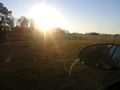
Somewhere in this (blurry) field was the hashpoint.

Achievements
Birdray earned the No trespassing consolation prize
|
Birdray earned the Prize poultry Consolation Prize
|