Difference between revisions of "2013-03-27 39 -76"
From Geohashing
imported>OfficeLinebacker (→Location) |
imported>OfficeLinebacker ([http://www.openstreetmap.org/?lat=39.57117343&lon=-76.06666165&zoom=16&layers=B000FTF @39.5712,-76.0667]) |
||
| Line 47: | Line 47: | ||
Image:2013-03-27_39_-76_14-34-44-073.jpg | Picnic gazebo [http://www.openstreetmap.org/?lat=39.53571240&lon=-76.10743135&zoom=16&layers=B000FTF @39.5357,-76.1074] | Image:2013-03-27_39_-76_14-34-44-073.jpg | Picnic gazebo [http://www.openstreetmap.org/?lat=39.53571240&lon=-76.10743135&zoom=16&layers=B000FTF @39.5357,-76.1074] | ||
| + | |||
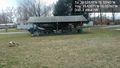
| + | Image:2013-03-27_39_-76_14-55-22-757.jpg | [http://www.openstreetmap.org/?lat=39.57117343&lon=-76.06666165&zoom=16&layers=B000FTF @39.5712,-76.0667] | ||
</gallery> | </gallery> | ||
Revision as of 18:55, 27 March 2013
| Wed 27 Mar 2013 in 39,-76: 39.5357028, -76.1074312 geohashing.info google osm bing/os kml crox |
Location
This is actually on some kind of parade ground or recreation field on an Army Reserve base
Participants
Plans
Expedition
- Going to go ahead and go for this 1 as well -- OfficeLinebacker (talk) @39.5298,-77.0942 12:27, 27 March 2013 (EDT)
- In a field next to a little league -- OfficeLinebacker (talk) @39.5223,-76.1838 14:14, 27 March 2013 (EDT)
Tracklog
Photos

Obligatory silly grin @39.5357,-76.1074
Picnic gazebo @39.5357,-76.1074


Achievements