Difference between revisions of "2013-05-05 36 14"
From Geohashing
imported>Yakamoz (→Achievements) |
imported>Rincewind (→Gallery) |
||
| Line 24: | Line 24: | ||
Image:2013-05-05_36_14_21-50-45-800.jpg | Distance from the ferry to the geohash point | Image:2013-05-05_36_14_21-50-45-800.jpg | Distance from the ferry to the geohash point | ||
</gallery> | </gallery> | ||
| + | |||
| + | == Achievements== | ||
| + | |||
| + | {{Virgin graticule| | ||
| + | Latitude= 36| | ||
| + | Longitude=14| | ||
| + | Name=Yakamoz and Rincewind | ||
| + | }} | ||
Revision as of 19:58, 5 May 2013
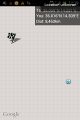
| Sun 5 May 2013 in 36,14: 36.0586859, 14.2308397 geohashing.info google osm bing/os kml crox |
Location
On a field on Gozo (Malta)
Participants
Plans
Go to Gozo to seightseeing and geohashing
Expedition
Will follow, when we are back..
Gallery
Distance from the ferry to the geohash point
