Difference between revisions of "2013-06-04 39 -77"
From Geohashing
imported>OfficeLinebacker ([http://www.openstreetmap.org/?lat=39.31100000&lon=-77.23650000&zoom=16&layers=B000FTF @39.3110,-77.2365]) |
imported>OfficeLinebacker ([http://www.openstreetmap.org/?lat=39.31100000&lon=-77.23650000&zoom=16&layers=B000FTF @39.3110,-77.2365]) |
||
| Line 61: | Line 61: | ||
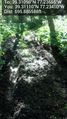
Image:2013-06-04_39_-77_23-32-11-608.jpg | [http://www.openstreetmap.org/?lat=39.31100000&lon=-77.23650000&zoom=16&layers=B000FTF @39.3110,-77.2365] | Image:2013-06-04_39_-77_23-32-11-608.jpg | [http://www.openstreetmap.org/?lat=39.31100000&lon=-77.23650000&zoom=16&layers=B000FTF @39.3110,-77.2365] | ||
| + | |||
| + | Image:2013-06-04_39_-77_23-32-29-743.jpg | [http://www.openstreetmap.org/?lat=39.31100000&lon=-77.23650000&zoom=16&layers=B000FTF @39.3110,-77.2365] | ||
</gallery> | </gallery> | ||
Revision as of 03:32, 5 June 2013
| Tue 4 Jun 2013 in 39,-77: 39.3109784, -77.2365543 geohashing.info google osm bing/os kml crox |
Location
Just off Moxley Rd near a path in Monrovia, MD
Participants
Plans
I had a Dr appt and decided to blow off work after and go straight there. I thought I could beat traffic (note the use of foreshadowing by the author).
Expedition
- Traffic is not too bad at the moment so I'm going to go through this one -- OfficeLinebacker (talk) @39.0317,-77.1312 15:54, 4 June 2013 (EDT)
- And it's already too late but I'm going to do it anyway -- OfficeLinebacker (talk) @39.2390,-77.2819 16:18, 4 June 2013 (EDT)
Tracklog
Photos

Bright light @39.3110,-77.2365
Not going to lie I took a risk getting my CRV through these mud bogs @39.3111,-77.2341


Achievements