Difference between revisions of "2013-08-25 44 -123"
From Geohashing
imported>Taper (→Participants) |
imported>Taper (→Plans) |
||
| Line 28: | Line 28: | ||
== Plans == | == Plans == | ||
<!-- what were the original plans --> | <!-- what were the original plans --> | ||
| + | I saw Friday that the hashes for [[2013-08-24_44_-123|Saturday]] and Sunday were relatively close to/in town, so decided to try for them; Saturday's expedition was called off when my phone/GPS battery died during journey preparations. "Sunday or bust!" I vowed. Well, no, not really. | ||
== Expedition == | == Expedition == | ||
Revision as of 03:29, 26 August 2013
| Sun 25 Aug 2013 in 44,-123: 44.0516226, -123.1574757 geohashing.info google osm bing/os kml crox |
Location
The West Eugene Wetlands, in Eugene, Oregon.
Participants
Plans
I saw Friday that the hashes for Saturday and Sunday were relatively close to/in town, so decided to try for them; Saturday's expedition was called off when my phone/GPS battery died during journey preparations. "Sunday or bust!" I vowed. Well, no, not really.
Expedition
Tracklog
Photos

Woo, hash in the rain. @44.0516,-123.1580
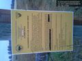
Ah, public land, and the hash point was almost directly on the trail.
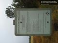
I missed this other sign going in, though. Um... oops? @44.0504,-123.1580


Achievements