Difference between revisions of "2013-09-11 -35 149"
From Geohashing
imported>1PE (→Photos) |
imported>FippeBot m (Location) |
||
| (One intermediate revision by one other user not shown) | |||
| Line 39: | Line 39: | ||
Image:2012-##-## ## ## Alpha.jpg | Witty Comment | Image:2012-##-## ## ## Alpha.jpg | Witty Comment | ||
--> | --> | ||
| + | <gallery> | ||
Image:2013-09-11_-35_149_12.36.49.jpg|Field with hash is behind. | Image:2013-09-11_-35_149_12.36.49.jpg|Field with hash is behind. | ||
Image:2013-09-11_-35_14912.46.05.jpg|End of north-facing runway. (Hash is several kilometers behind, almost in line.) | Image:2013-09-11_-35_14912.46.05.jpg|End of north-facing runway. (Hash is several kilometers behind, almost in line.) | ||
| Line 54: | Line 55: | ||
[[Category:Coordinates not reached]] | [[Category:Coordinates not reached]] | ||
[[Category:Not reached - No public access]] | [[Category:Not reached - No public access]] | ||
| + | {{location|AU|ACT}} | ||
Latest revision as of 03:57, 14 August 2019
| Wed 11 Sep 2013 in -35,149: -35.2599599, 149.2024075 geohashing.info google osm bing/os kml crox |
Location
A field on a farm just east of Majura Road, near Canberra Airport.
Participants
Plans
- 1PE - Lunchtime excursion, leaving a note for the land-holders.
Expedition
- 1PE
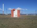
- Avonley Road runs of Majura Road, and at its end is a locked gate onto the farm beyond. Beside the gate is a small cottage, that backs onto the field where the hash is sited up a slight rise. I took some pictures from near the house, as gates/fences marked a no-go field. I left the map with a note at the cottage.
- On the way back, I turned onto a road at the end of the Canberra airport runway, and recorded what is there.
Photos

Field with hash is behind.
End of north-facing runway. (Hash is several kilometers behind, almost in line.)
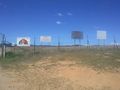
And, near them both, a gunnery range.


