Difference between revisions of "2013-11-30 43 -121"
imported>Frogman (→Expedition) |
imported>Frogman (→Photos) |
||
| Line 49: | Line 49: | ||
--> | --> | ||
<gallery perrow="5"> | <gallery perrow="5"> | ||
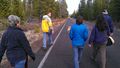
| + | Image:2013-11-30 43 -121 ontheway.jpg | On the way there! | ||
| + | Image:2013-11-30 43 -121 tracks1.jpg | We made tracks in the mud. | ||
| + | Image:2013-11-30 43 -121 tracks2.jpg | It felt weird to step in it. | ||
| + | Image:2013-11-30 43 -121 ontheway2.jpg | Almost there! | ||
| + | Image:2013-11-30 43 -121 proof.jpg | Proof! If a bit blurry. | ||
| + | Image:2013-11-30 43 -121 plsgivepie.jpg | Daisy wants some pie! | ||
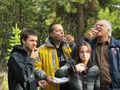
| + | Image:2013-11-30 43 -121 grins.jpg | Goofy grins. | ||
| + | Image:2013-11-30 43 -121 pie1.jpg | Eating the pie. | ||
| + | Image:2013-11-30 43 -121 pie2.jpg | Omnomnom | ||
| + | Image:2013-11-30 43 -121 piedog.jpg | Daisy got some too! | ||
| + | Image:2013-11-30 43 -121 pietree.jpg | The pie box on a tree. | ||
| + | Image:2013-11-30 43 -121 hashpoint.jpg | Relaxing at the hashpoint. | ||
| + | Image:2013-11-30 43 -121 daisy.jpg | Hello yes I am dog | ||
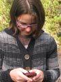
| + | Image:2013-11-30 43 -121 glasses.jpg | Leah's face | ||
| + | Image:2013-11-30 43 -121 omgmybff.jpg | Leah had to text all her BFFs about her geohashing adventures. | ||
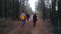
| + | Image:2013-11-30 43 -121 goinghome.jpg | On the way back! | ||
| + | Image:2013-11-30 43 -121 road1.jpg | A dirt road. | ||
| + | Image:2013-11-30 43 -121 road2.jpg | A paved road. | ||
</gallery> | </gallery> | ||
Revision as of 01:58, 1 December 2013
| Sat 30 Nov 2013 in 43,-121: 43.8491884, -121.5767650 geohashing.info google osm bing/os kml crox |
Location
In the Deschutes National Forest west of Three Rivers, Oregon.
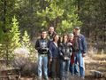
Participants
Plans
This hashpoint was closer to our location than yesterday's, but it looked like a longer walk. We decided to go for the Pie achievement!
Expedition
After sleeping in and having a big breakfast, we put on our warm clothes and left. We almost forgot the pie, so we turned back to retrieve it.
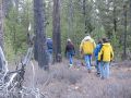
We parked off of National Forest road #40 and tried to take as straight a path as possible to the hashpoint. Large, dead trees caused us to zig-zag a bit, so we ended up bearing too far towards due west at the start. Our journey was also slowed by the mud. The mud was rigid and filled with mostly air, causing our feet to sink fairly far into the mud with a satisfying crunch.
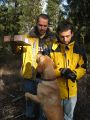
At the hashpoint, we took picture including some goofy grins and some not-so-goofy grins. Some of us had some pumpkin pie, and Daisy found a lot of interesting sticks.
On the walk back, we took a side road that was unmarked on Google Maps back to NF-40 instead of beelining through the forest. We saw a guy in a truck with his dog! He passed us three times - he had to go back to pick up his bicycle, which had fallen off of the truck. By the time we got back to the van our shoes were very muddy.
Tracklog
Photos
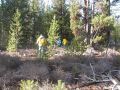
On the way there!
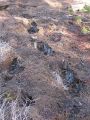
We made tracks in the mud.
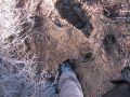
It felt weird to step in it.
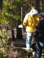
Almost there!
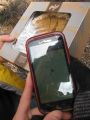
Proof! If a bit blurry.
Daisy wants some pie!
Goofy grins.
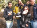
Eating the pie.
Omnomnom
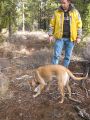
Daisy got some too!
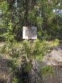
The pie box on a tree.
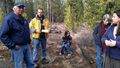
Relaxing at the hashpoint.
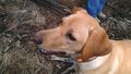
Hello yes I am dog

Leah's face
Leah had to text all her BFFs about her geohashing adventures.
On the way back!
A dirt road.
A paved road.


Achievements