Difference between revisions of "2013-12-22 46 6"
imported>Crox (pictures and report will follow) |
m |
||
| (2 intermediate revisions by 2 users not shown) | |||
| Line 21: | Line 21: | ||
== Participants == | == Participants == | ||
| − | [[user:Crox|Crox]] | + | [[user:Crox|Crox]] and [[user:Elisa|Elisa]] |
== Plans == | == Plans == | ||
| Line 27: | Line 27: | ||
== Expedition == | == Expedition == | ||
| − | + | Since we were in the area anyway that day, we could not miss this opportunity to get the [[Golf geohash achievement]], despite having some doubts about the reachability by looking at the aerial imagery... Unfortunately, by the time we boarded the train to Nyon it was already getting late, which meant we would be walking in the dark. The planning page was updated with an ETA. | |
| − | + | Everything then went as planned, we walked in the dark towards the hashpoint, and found it was indeed behind the fences that can be seen on Google satellite view. Since it was already dark finding someone to ask for permission was unlikely, and in doubt we decided not to cross the fence. So we went back the same way we came, in the now completely dark woods. | |
| − | + | ||
| + | Despite failing to reach the coordinates we had a nice time and enjoyed getting some fresh air. | ||
== Photos == | == Photos == | ||
| − | + | {{#vardefine:gaLines|3}} | |
| − | + | {{#vardefine:gaWidth|250}} | |
| − | + | {{#vardefine:gaHeight|230}} | |
| − | + | {{Gallery2| | |
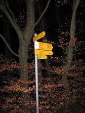
| − | + | {{GalleryItem | File:2013-12-22_46_6-IMG_2746.JPG| Let's start the expedition! }} | |
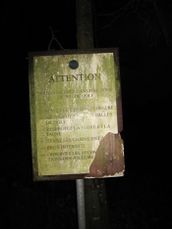
| − | + | {{GalleryItem | File:2013-12-22_46_6-IMG_2747.JPG| [[Golf geohash achievement|Golf geohash]] }} | |
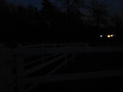
| − | + | {{GalleryItem | File:2013-12-22_46_6-IMG_2752.JPG| The hash lies somewhere behind these fences... }} | |
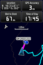
| − | {{#vardefine: | + | {{GalleryItem | File:2013-12-22_46_6-1220.png| This is about as close as we got. }} |
| − | + | }} | |
| − | |||
| − | |||
| − | |||
| − | |||
| − | [[ | ||
| − | |||
| − | |||
| − | |||
| − | |||
| − | |||
[[Category:Expeditions]] | [[Category:Expeditions]] | ||
| + | [[Category:Coordinates not reached]] | ||
[[Category:Not reached - No public access]] | [[Category:Not reached - No public access]] | ||
| − | |||
| − | |||
[[Category:Expeditions with photos]] | [[Category:Expeditions with photos]] | ||
| − | + | {{location|CH|VD}} | |
| − | |||
| − | |||
| − | |||
| − | |||
| − | |||
| − | |||
| − | |||
| − | |||
| − | |||
| − | |||
| − | |||
| − | |||
| − | |||
| − | |||
| − | |||
| − | |||
| − | |||
| − | |||
| − | |||
| − | |||
| − | |||
| − | |||
| − | |||
Latest revision as of 09:10, 12 September 2021
| Sun 22 Dec 2013 in 46,6: 46.3972814, 6.2729142 geohashing.info google osm bing/os kml crox |
Location
Domaine Impérial Golf Club, Prangins, Switzerland (map.geo.admin.ch)
Participants
Plans
ETA 17:45
Expedition
Since we were in the area anyway that day, we could not miss this opportunity to get the Golf geohash achievement, despite having some doubts about the reachability by looking at the aerial imagery... Unfortunately, by the time we boarded the train to Nyon it was already getting late, which meant we would be walking in the dark. The planning page was updated with an ETA.
Everything then went as planned, we walked in the dark towards the hashpoint, and found it was indeed behind the fences that can be seen on Google satellite view. Since it was already dark finding someone to ask for permission was unlikely, and in doubt we decided not to cross the fence. So we went back the same way we came, in the now completely dark woods.
Despite failing to reach the coordinates we had a nice time and enjoyed getting some fresh air.
Photos
|


