Difference between revisions of "2014-03-14 51 12"
From Geohashing
imported>TFTD |
imported>TFTD (→Photos) |
||
| Line 41: | Line 41: | ||
--> | --> | ||
<gallery perrow="5"> | <gallery perrow="5"> | ||
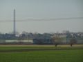
| + | Image:2014-03-13 51-12 Powerstation.jpg | A powerstation near Schkopau along the way. | ||
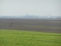
| + | Image:2014-03-13 51-12 Graduation tower.jpg | A graduation tower in Bad Dürrenberg, I never knew was there. | ||
| + | Image:2014-03-13_51-12_Graduation_tower_close-up.jpg | A close-up of the graduation tower. | ||
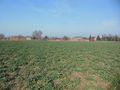
| + | Image:2014-03-13 51-12 The hash.jpg | My bike in front of the field with the hash. In the background you can see the farmer. | ||
| + | Image:2014-03-13 51-12_arealpic1.jpg | Areal picture taken while waiting for the farmer to leave his field. | ||
| + | Image:2014-03-13 51-12 CoordinateProof.jpg | Coordinate proof. | ||
| + | Image:2014-03-13_51-12_Coordinate2Ragwitz.jpg | Picture standing on the coordinates towards Ragwitz. | ||
| + | Image:2014-03-13_51-12_Lunchtime.jpg | Finally some food! | ||
| + | Image:2014-03-13_51-12_sign.jpg | A funny sign stating that you are welcome to the industry and garden city of Leuna. | ||
| + | Image:2014-03-13_51-12_Tram.jpg | On of the longest tram lines in the world at work. | ||
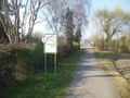
| + | Image:2014-03-13_51-12_CdS.jpg | A Camino de Satniago de Compostela crossing my path. | ||
</gallery> | </gallery> | ||
Revision as of 11:39, 15 March 2014
| Fri 14 Mar 2014 in 51,12: 51.2742678, 12.1086302 geohashing.info google osm bing/os kml crox |
Location
It is on a field south of Ragwitz.
Participants
Plans
If the weather stays as it was the last days I plan for a bike ride from the western part of Halle to the place and back.
Expedition
Tracklog
Photos
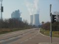
A powerstation near Schkopau along the way.
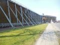
A graduation tower in Bad Dürrenberg, I never knew was there.
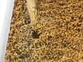
A close-up of the graduation tower.
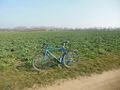
My bike in front of the field with the hash. In the background you can see the farmer.
Areal picture taken while waiting for the farmer to leave his field.
Coordinate proof.
Picture standing on the coordinates towards Ragwitz.
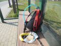
Finally some food!
A funny sign stating that you are welcome to the industry and garden city of Leuna.
On of the longest tram lines in the world at work.
A Camino de Satniago de Compostela crossing my path.


Achievements