Difference between revisions of "2014-04-08 44 -123"
imported>Frogman (→Expedition) |
imported>Frogman (→Photos) |
||
| Line 40: | Line 40: | ||
--> | --> | ||
<gallery perrow="5"> | <gallery perrow="5"> | ||
| + | Image:2014-04-08 44 -123 driving.jpg | Driving there! | ||
| + | Image:2014-04-08 44 -123 gas station.jpg | We stopped at a gas station about a kilometer from the hashpoint. | ||
| + | Image:2014-04-08 44 -123 parked.jpg | We parked near a restaurant at a truck stop. | ||
| + | Image:2014-04-08 44 -123 truck stop.jpg | The truck stop! | ||
| + | Image:2014-04-08 44 -123 concrete.jpg | There were large piles of concrete near the parking lot. | ||
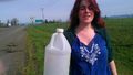
| + | Image:2014-04-08 44 -123 proof.jpg | Proof! | ||
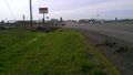
| + | Image:2014-04-08 44 -123 signs.jpg | Nearby road signs. Wow. Such scenery. | ||
| + | Image:2014-04-08 44 -123 google glass.jpg | Greg configuring his Google Glass for a group photo. | ||
| + | Image:2014-04-08 44 -123 grins.jpg | Goofy grins! | ||
| + | Image:2014-04-08 44 -123 highway.jpg | In the distance one can see the intersection with I-5. | ||
| + | Image:2014-04-08 44 -123 geotrash.jpg | Callie geotrashing. | ||
</gallery> | </gallery> | ||
Revision as of 03:51, 9 April 2014
| Tue 8 Apr 2014 in 44,-123: 44.5555999, -123.0549325 geohashing.info google osm bing/os kml crox |
Location
On the side of Highway 34, near a truck stop and the I-5 intersection.
Participants
Plans
I was busy with class when Michael5000 sent me a message: "I see a truck stop in your future." I quickly checked the coordinates and, seeing that he was correct, couldn't concentrate for the rest of the day. I was planning on biking this, but Alec, Callie, and Greg all agreed to go, so we took Greg's truck.
Expedition
Because we were in a truck, we were allowed to park at the truck stop. We strolled over to the hashpoint, which was easily accessible at the side of the road. Cars and trucks zoomed past us as we took pictures and congratulated ourselves. The hashpoint was very messy, so Callie took the opportunity to Geotrash.
Tracklog
Photos
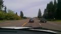
Driving there!

We stopped at a gas station about a kilometer from the hashpoint.
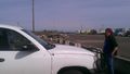
We parked near a restaurant at a truck stop.
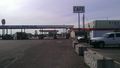
The truck stop!
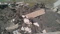
There were large piles of concrete near the parking lot.
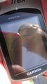
Proof!
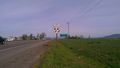
Nearby road signs. Wow. Such scenery.
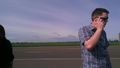
Greg configuring his Google Glass for a group photo.
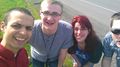
Goofy grins!
In the distance one can see the intersection with I-5.
Callie geotrashing.


Achievements