Difference between revisions of "2014-04-25 51 -115"
From Geohashing
imported>Guzzby (→Photos) |
imported>Guzzby (→Photos) |
||
| Line 50: | Line 50: | ||
Image:2014-04-25_51_-115_guzzbyb.jpg | Rock snowman | Image:2014-04-25_51_-115_guzzbyb.jpg | Rock snowman | ||
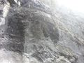
Image:2014-04-25_51_-115_guzzbyc.jpg | Is that a bear cave? | Image:2014-04-25_51_-115_guzzbyc.jpg | Is that a bear cave? | ||
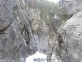
| − | Image:2014-04-25_51_-115_guzzbyd.jpg | + | Image:2014-04-25_51_-115_guzzbyd.jpg | As far as I went |
</gallery> | </gallery> | ||
Revision as of 18:50, 26 April 2014
| Fri 25 Apr 2014 in 51,-115: 51.0694246, -115.2170305 geohashing.info google osm bing/os kml crox |
Location
1 km NE of Grotto Mountain Pond 2 km west of Exshaw, Alberta Canada
Participants
Plans
Expedition
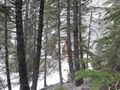
Photos
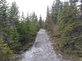
Start of trail
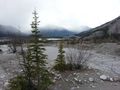
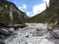
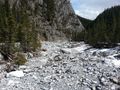
View of creek bed
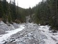
Trail joins creek bed
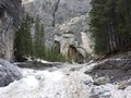
Approaching ground zero
View from "Love Grotto" geocache
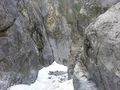
Geohash is 50 meters north beyond this cliff face!
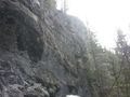
Another view of cliff
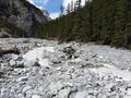
Continuing up the trail
Continuing up the trail
Near "Grotto Canyon View" geocache
Rock snowman
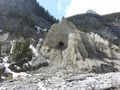
Is that a bear cave?
As far as I went


Achievements