Difference between revisions of "2014-05-16 48 9"
imported>Ekorren (Plans. More or less.) |
imported>Ekorren (Gallery) |
||
| Line 22: | Line 22: | ||
== Gallery == | == Gallery == | ||
<gallery> | <gallery> | ||
| + | File:2014-05-16_48_9_01_WurmlingerKapellenberg.JPG|Wurmlingen chapel hill | ||
| + | File:2014-05-16_48_9_02_Pole.JPG|It's turning in the wind. Not showing an direction, though. | ||
| + | File:2014-05-16_48_9_03_VerschmusteFahrbahn.JPG|"'''Cuddly road surface'''"<br>I thought it didn't look very cuddly, and I haven't actually tried. | ||
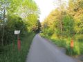
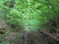
| + | File:2014-05-16_48_9_04_Wurmlingen.JPG|On the way to Wurmlingen | ||
| + | File:2014-05-16_48_9_05_Notclosed.JPG|"'''Closed from 20:00'''".<br>It ''was'' past 20:00, but there wasn't any kind of bar to close with... | ||
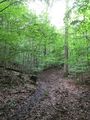
| + | File:2014-05-16_48_9_06_Trees.JPG|Just some trees | ||
| + | File:2014-05-16_48_9_07_Raptor.JPG|Monsters block the way to the hash! | ||
| + | File:2014-05-16_48_9_08_hunters.JPG|And here the NSA hides to observe hashers! | ||
| + | File:2014-05-16_48_9_09_GPS.JPG|Goordinates reached. | ||
| + | File:2014-05-16_48_9_10_VFH1.JPG|View from hash | ||
| + | File:2014-05-16_48_9_11_VFH2.JPG|View from hash | ||
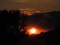
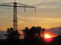
| + | File:2014-05-16_48_9_12_Sunset1.JPG|Here goes a sun. | ||
| + | File:2014-05-16_48_9_13_Sunset2.JPG | ||
</gallery> | </gallery> | ||
Revision as of 16:59, 17 May 2014
| Fri 16 May 2014 in 48,9: 48.5122346, 9.0082571 geohashing.info google osm bing/os kml crox |
Location
Between Tübingen and Unterjesingen and Wurmlingen, between the Ammer valley and the Spitzberg mountain, in a forest. Whether the exact spot belongs to Tübingen or to the Rottenburg exclave, isn't determinable from the map.
Participants
Ekorren will probably go there during the day.
You?
Expedition plans
Go there by bike on the way to Rottenburg or back. If someone else wants to go, please drop me a note and I might try to go at the same time. --Ekorren (talk) 13:30, 15 May 2014 (EDT)
Gallery
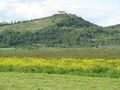
Wurmlingen chapel hill
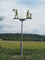
It's turning in the wind. Not showing an direction, though.
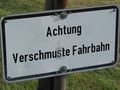
"Cuddly road surface"
I thought it didn't look very cuddly, and I haven't actually tried.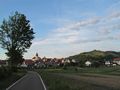
On the way to Wurmlingen
"Closed from 20:00".
It was past 20:00, but there wasn't any kind of bar to close with...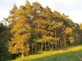
Just some trees
Monsters block the way to the hash!
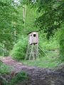
And here the NSA hides to observe hashers!
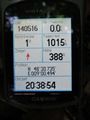
Goordinates reached.
View from hash
View from hash
Here goes a sun.