Difference between revisions of "2014-07-14 48 8"
From Geohashing
imported>Ekorren (Went there) |
imported>FippeBot m (Location) |
||
| (3 intermediate revisions by 2 users not shown) | |||
| Line 2: | Line 2: | ||
| lat=48 | | lat=48 | ||
| lon=8 | | lon=8 | ||
| − | | date=2014-07- | + | | date=2014-07-14 |
}} | }} | ||
| Line 19: | Line 19: | ||
== Gallery == | == Gallery == | ||
<gallery> | <gallery> | ||
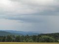
| − | + | 2014-07-14_48_8_5790.JPG|Somewhere behind the hills | |
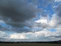
| + | 2014-07-14_48_8_5791.JPG|For the believers | ||
| + | 2014-07-14_48_8_5795.JPG|A collection of old border markers | ||
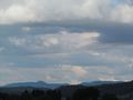
| + | 2014-07-14_48_8_5797.JPG|This is as close as it gets | ||
| + | 2014-07-14_48_8_5799.JPG|Clouds around the hash | ||
| + | 2014-07-14_48_8_5800.JPG | ||
| + | 2014-07-14_48_8_5801.JPG | ||
| + | 2014-07-14_48_8_5802.JPG | ||
| + | 2014-07-14_48_8_5803.JPG|Rottenburg | ||
</gallery> | </gallery> | ||
[[Category:Expeditions]] | [[Category:Expeditions]] | ||
| − | |||
[[Category:Expeditions with photos]] | [[Category:Expeditions with photos]] | ||
[[Category:Coordinates not reached]] | [[Category:Coordinates not reached]] | ||
[[Category:Not reached - No public access]] | [[Category:Not reached - No public access]] | ||
| − | + | {{location|DE|BW|BL}} | |
Latest revision as of 00:43, 15 August 2019
| Mon 14 Jul 2014 in 48,8: 48.4024204, 8.8453082 geohashing.info google osm bing/os kml crox |
Contents
Location
Rangendingen-Höfendorf, a field full of oat.
Participants
Ekorren went there by bike.
Expedition
I went there by bike. Is there much more to say? If so, the pictures will tell a bit.
Gallery
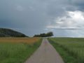
Somewhere behind the hills
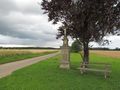
For the believers
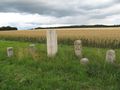
A collection of old border markers
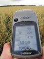
This is as close as it gets
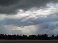
Clouds around the hash

Rottenburg


