Difference between revisions of "2015-01-15 51 13"
imported>Oisín (→Achievements) |
imported>FippeBot m (Location) |
||
| (4 intermediate revisions by 2 users not shown) | |||
| Line 4: | Line 4: | ||
| date=2015-01-15 | | date=2015-01-15 | ||
}} | }} | ||
| − | |||
| − | |||
__NOTOC__ | __NOTOC__ | ||
== Location == | == Location == | ||
| − | + | Today's location is in the [[wikipedia:Allotment (gardening)|allotment garden/community garden]] "Hubertus 1905" in Dresden. | |
| + | |||
| + | Country: Germany; state: Sachsen (Saxony, EU:DE:SN); district: Dresden; Stadtteil: Pieschen-Nord/Trachenberge | ||
| + | |||
== Participants == | == Participants == | ||
| − | [[User:Oisín|Oisín]] | + | *[[User:Oisín|Oisín]] |
| + | *[[User:Danatar|Danatar]] | ||
| − | == Plans == | + | |
| + | ==Oisín== | ||
| + | |||
| + | === Plans === | ||
From the map, the hash is not accessible to the public: it is in an area with small private gardens. But it is less then half a kilometer from my home thus I have to give it a try :-). | From the map, the hash is not accessible to the public: it is in an area with small private gardens. But it is less then half a kilometer from my home thus I have to give it a try :-). | ||
| − | == Expedition == | + | === Expedition === |
After work I cycled first to the market to do some of my shopping and only managed to make it to the hash location shortly after 5 pm. It was already dark (thus sorry for the pictures :-)). I couldn't get closer than about 33m. | After work I cycled first to the market to do some of my shopping and only managed to make it to the hash location shortly after 5 pm. It was already dark (thus sorry for the pictures :-)). I couldn't get closer than about 33m. | ||
| − | I'm a little disappointed to not being able to reach the hash as this would have been one of the rare [[Couch Potato Geohash]] honorable mentions. | + | I'm a little disappointed to not being able to reach the hash as this would have been one of the rare [[Couch Potato Geohash]] honorable mentions at 303m from my living room. |
| − | == | + | === Photos === |
| − | |||
| − | |||
| − | == | ||
<!-- Insert pictures between the gallery tags using the following format: | <!-- Insert pictures between the gallery tags using the following format: | ||
Image:2012-##-## ## ## Alpha.jpg | Witty Comment | Image:2012-##-## ## ## Alpha.jpg | Witty Comment | ||
--> | --> | ||
<gallery perrow="5"> | <gallery perrow="5"> | ||
| − | |||
| − | |||
Image:2015-01-15_51_13_Oisín_1421337839268.jpg | Closed path [http://www.openstreetmap.org/?lat=51.09186254&lon=13.72649557&zoom=16&layers=B000FTF @51.0919,13.7265] | Image:2015-01-15_51_13_Oisín_1421337839268.jpg | Closed path [http://www.openstreetmap.org/?lat=51.09186254&lon=13.72649557&zoom=16&layers=B000FTF @51.0919,13.7265] | ||
| − | |||
Image:2015-01-15_51_13_Oisín_1421337875964.jpg | View from closest accessible point [http://www.openstreetmap.org/?lat=51.09178328&lon=13.72657721&zoom=16&layers=B000FTF @51.0918,13.7266] | Image:2015-01-15_51_13_Oisín_1421337875964.jpg | View from closest accessible point [http://www.openstreetmap.org/?lat=51.09178328&lon=13.72657721&zoom=16&layers=B000FTF @51.0918,13.7266] | ||
</gallery> | </gallery> | ||
| − | == Achievements == | + | === Achievements === |
{{#vardefine:ribbonwidth|800px}} | {{#vardefine:ribbonwidth|800px}} | ||
| Line 48: | Line 47: | ||
| − | + | ==Danatar== | |
| − | + | As Oisín already mentioned it was clear that this expedition would almost certainly not reach the spot, but I had lots of free time and every Not Trespassing consolation prize gets me nearer to the Posted achievement. Also, ''another'' hashpoint in an allotment garden? The 2014-12-28 spot had already been in one, in the southern part of Dresden, but with lots of snow on that day I didn't even try. A quick internet search tells me that there are 374 allotment gardens in Dresden, with about one parcel for every 10 inhabitants of Dresden and a total area of 2.3 % of the city area. | |
| + | |||
| + | I cycled over the Waldschlösschenbrücke, from where I could see the moderate high-water currently occurring. The water was 2-2.3 meters higher than usual (and already 1 meter less than last Monday) and it reached the upper edge of the bank, but at least in Dresden there's almost no land flooded; in comparison, the very bad flooding of 2002 was more than eight meters above normal. I cycled along the Stauffenbergallee, then along some other streets until I was near the hashpoint. The last street was only a dirt track. A few minutes before 3 p.m. I stood before a closed gate. This was a bit surprising because I had expected to be stopped only at the last parcel, 10 meters of the spot. On a day with better weather and thus many people in the allotment this would probably have been the case. I tried the other gates, but all of them were closed, so I started my journey back. On the way, I made some detours to go shopping. | ||
| − | |||
| − | |||
| − | |||
| − | -- | + | {{gallery|width=200|height=200|lines=2 |
| + | |Image:2015-01-15_51_13_hochwasser.jpg|high water | ||
| + | |Image:2015-01-15_51_13_schrebergarten1.jpg|almost there | ||
| + | |Image:2015-01-15_51_13_schrebergarten2.jpg|no trespassing near the spot | ||
| + | |Image:2015-01-15_51_13_schrebergarten3.jpg|no trespassing from the other side | ||
| + | |Image:2015-01-15_51_13_schrebergarten4.jpg|looking into the allotment | ||
| + | }} | ||
| + | |||
| + | |||
| + | [http://www.everytrail.com/view_trip.php?trip_id=3105768&code=5cbd33054bcce25b243a643f0544c9e3 triton tracklog] | ||
| + | [[Category:Expeditions]] | ||
| + | [[Category:Expeditions with photos]] | ||
| + | [[Category:Danatar]] | ||
[[Category:Coordinates not reached]] | [[Category:Coordinates not reached]] | ||
[[Category:Not reached - No public access]] | [[Category:Not reached - No public access]] | ||
| + | {{location|DE|SN|DD}} | ||
Latest revision as of 02:25, 15 August 2019
| Thu 15 Jan 2015 in 51,13: 51.0921498, 13.7265104 geohashing.info google osm bing/os kml crox |
Location
Today's location is in the allotment garden/community garden "Hubertus 1905" in Dresden.
Country: Germany; state: Sachsen (Saxony, EU:DE:SN); district: Dresden; Stadtteil: Pieschen-Nord/Trachenberge
Participants
Oisín
Plans
From the map, the hash is not accessible to the public: it is in an area with small private gardens. But it is less then half a kilometer from my home thus I have to give it a try :-).
Expedition
After work I cycled first to the market to do some of my shopping and only managed to make it to the hash location shortly after 5 pm. It was already dark (thus sorry for the pictures :-)). I couldn't get closer than about 33m.
I'm a little disappointed to not being able to reach the hash as this would have been one of the rare Couch Potato Geohash honorable mentions at 303m from my living room.
Photos
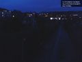
Closed path @51.0919,13.7265

View from closest accessible point @51.0918,13.7266


Achievements
Oisín earned the No trespassing consolation prize
|
Danatar
As Oisín already mentioned it was clear that this expedition would almost certainly not reach the spot, but I had lots of free time and every Not Trespassing consolation prize gets me nearer to the Posted achievement. Also, another hashpoint in an allotment garden? The 2014-12-28 spot had already been in one, in the southern part of Dresden, but with lots of snow on that day I didn't even try. A quick internet search tells me that there are 374 allotment gardens in Dresden, with about one parcel for every 10 inhabitants of Dresden and a total area of 2.3 % of the city area.
I cycled over the Waldschlösschenbrücke, from where I could see the moderate high-water currently occurring. The water was 2-2.3 meters higher than usual (and already 1 meter less than last Monday) and it reached the upper edge of the bank, but at least in Dresden there's almost no land flooded; in comparison, the very bad flooding of 2002 was more than eight meters above normal. I cycled along the Stauffenbergallee, then along some other streets until I was near the hashpoint. The last street was only a dirt track. A few minutes before 3 p.m. I stood before a closed gate. This was a bit surprising because I had expected to be stopped only at the last parcel, 10 meters of the spot. On a day with better weather and thus many people in the allotment this would probably have been the case. I tried the other gates, but all of them were closed, so I started my journey back. On the way, I made some detours to go shopping.
|


