Difference between revisions of "2015-07-27 49 8"
From Geohashing
imported>Tads |
imported>Tads (→Photos) |
||
| Line 41: | Line 41: | ||
--> | --> | ||
<gallery perrow="5"> | <gallery perrow="5"> | ||
| + | Image:tads_2015-07-27_49_8_proof1.png | GPS proof | ||
| + | Image:tads_2015-07-27_49_8_view-east.jpg | View to the east | ||
| + | Image:tads_2015-07-27_49_8_view-north.jpg | View to the north | ||
| + | Image:tads_2015-07-27_49_8_view-south.jpg | View to the south | ||
| + | Image:tads_2015-07-27_49_8_view-west.jpg | View to the west | ||
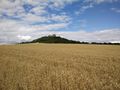
| + | Image:tads_2015-07-27_49_8_VesteOtzberg.jpg | The Veste Otzberg is very close | ||
| + | Image:tads_2015-07-27_49_8_view-to-VesteOtzberg.jpg | Looking back to the Veste Otzberg | ||
| + | Image:tads_2015-07-27_49_8_OnTheWayBack1.jpg | Crop fields on the way back | ||
| + | Image:tads_2015-07-27_49_8_OnTheWayBack2.jpg | More fields on the way back | ||
</gallery> | </gallery> | ||
Revision as of 14:30, 4 September 2015
| Mon 27 Jul 2015 in 49,8: 49.8278308, 8.9195462 geohashing.info google osm bing/os kml crox |
Location
The hashpoint is located on a field in Otzberg-Zipfen.
Participants
Plans
tads considers going to the hashpoint by train and bike on Monday afternoon. He might additionally visit Otzberg Castle which is close by.
Expedition
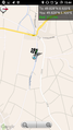
Tracklog
Photos
GPS proof
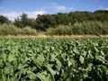
View to the east
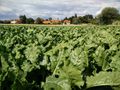
View to the north
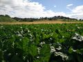
View to the south

View to the west
The Veste Otzberg is very close
Looking back to the Veste Otzberg
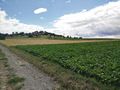
Crop fields on the way back
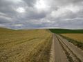
More fields on the way back


Achievements