Difference between revisions of "2015-08-15 49 8"
imported>DODO (→Tracklog) |
imported>DODO (→Photos) |
||
| Line 47: | Line 47: | ||
Image:2012-##-## ## ## Alpha.jpg | Witty Comment | Image:2012-##-## ## ## Alpha.jpg | Witty Comment | ||
--> | --> | ||
| − | <gallery perrow=" | + | <gallery perrow="6"> |
| + | Image:2015-08-15_49_8-1.jpg|my bike | ||
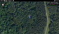
| + | Image:2015-08-15_49_8-2.jpg|view in the hash-direction | ||
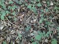
| + | Image:2015-08-15_49_8-3.jpg|a lot of arum on my way | ||
| + | Image:2015-08-15_49_8-4.jpg|proof one | ||
| + | Image:2015-08-15_49_8-13.png|second device is also satisfied | ||
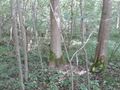
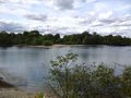
| + | Image:2015-08-15_49_8-5.jpg|pretty much the same view in any direction | ||
| + | Image:2015-08-15_49_8-6.jpg|except in this: there's a bigger tree | ||
| + | Image:2015-08-15_49_8-7.jpg|and in this direction: there's a happy hasher | ||
| + | Image:2015-08-15_49_8-9.jpg|little mark | ||
| + | Image:2015-08-15_49_8-10.jpg|little raptor | ||
| + | Image:2015-08-15_49_8-11.jpg|big beer | ||
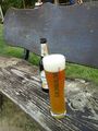
| + | Image:2015-08-15_49_8-12.jpg|view from the bench in the beer garden | ||
</gallery> | </gallery> | ||
Revision as of 19:30, 15 August 2015
| Sat 15 Aug 2015 in 49,8: 49.4134064, 8.4930074 geohashing.info google osm bing/os kml crox |
Location
A forest between Altrip and Waldsee.
Participants
Plans
To close, not to go (and the hash wasn't that close for almost two month). Don't know exactly what time it'll be. Anyone else to come?
Expedition
Little girl became 18 yesterday, and so I had to spend the morning with cleaning up, making breakfast for some bleary-eyed people and doing some household-stuff. So it was almost 3 pm when I could start, what met pretty good with a saturday meetup.
I know that way pretty good and so half an hour later I found myself on a forest path 70 m from the hash. From here on things got a (very) little bit weird. GPS reception was not that good and so the direction arrow was jumping from left to right and back while the distance stays nearly constant at 20 m. Then I realized that the device knows where I am (and so the distance is correct), but it can't determine my direction. So I tried to move faster to make the direction more obvious, and some seconds later I was within the circle of uncertainty. I took some pictures, build a quick mark and ... had no idea in which direction I left my bike. But it was just 70 m away, so I finally found it. Back on the path I waited until 4, and I used the time to search for ticks. That turned out as a good idea as I found two of them. One of them was bigger than usual and has an unusual color, so I wasn't sure that it was a tick, but wikipedia says, it was. At least it was big enough to take a photo of it.
On my way home I stopped at a beer garden where I've never been before. And it turned out that it was a very nice one. I'll certainly come back.
Tracklog
Photos
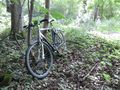
my bike
view in the hash-direction
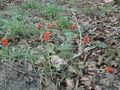
a lot of arum on my way
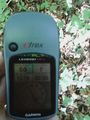
proof one
second device is also satisfied
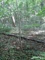
pretty much the same view in any direction
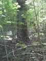
except in this: there's a bigger tree

and in this direction: there's a happy hasher
little mark

little raptor
big beer
view from the bench in the beer garden


Achievements