Difference between revisions of "2016-05-01 global"
From Geohashing
imported>Thomcat ([live picture]Lewis and Clark Bridge [http://www.openstreetmap.org/?lat=46.09850580&lon=-122.98446650&zoom=16&layers=B000FTF @46.0985,-122.9845]) |
imported>Thomcat ([live] 186 mi, 3 hrs 16 min.) |
||
| Line 52: | Line 52: | ||
| + | |||
| + | *186 mi, 3 hrs 16 min. -- [[User:Thomcat|Thomcat]] ([[User talk:Thomcat|talk]]) [http://www.openstreetmap.org/?lat=46.19420530&lon=-123.76956240&zoom=16&layers=B000FTF @46.1942,-123.7696] 15:58, 1 May 2016 (PDT) | ||
== Tracklog == | == Tracklog == | ||
<!-- if your GPS device keeps a log, you may post a link here --> | <!-- if your GPS device keeps a log, you may post a link here --> | ||
Revision as of 23:00, 1 May 2016
|
Globalhash on Sun 1 May 2016: |
Location
Behind some apartments in Astoria, Oregon
Participants
Plans
None yet, except Jim is thinking about how to get there and what he has to arrange to make that happen.
- Thomcat is going to be coming down from Seattle for a birthday globalhash
- Jim's going to be coming from Beaverton/Hillsboro, and will be free to start out around 11:30 or Noon due to an earlier morning commitment.
- Shmur's coming from PDX, but I'm not sure if they are interested in carpooling.
- Zhukant is planning on heading there, and to the coast, with a drag-along.
It sounds like everyone is going independently. I think we're aiming for maybe about 4PM. Maybe we should meet out near Hwy 30 before venturing in closer?
- En route solo in a few minutes; meeting at the intersection of Highway 30 and Nimitz Drive makes sense. --Thomcat (talk) 19:33, 1 May 2016 (UTC)
Expedition
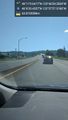
- Making good time, should be at highway 30 and Nimitz at 3:50. -- Thomcat (talk) @46.8383,-122.9859 14:06, 1 May 2016 (PDT)
- Jim is also en route, solo, and is just leaving Claskanie, so I'm about an hour away. Jiml (talk) 21:23, 1 May 2016 (UTC)
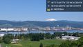
- 186 mi, 3 hrs 16 min. -- Thomcat (talk) @46.1942,-123.7696 15:58, 1 May 2016 (PDT)
Tracklog
Photos
Sculptures @46.4318,-122.8898
Lewis and Clark Bridge @46.1093,-122.9576
Lewis and Clark Bridge @46.0985,-122.9845


Achievements