2017-01-03 55 37
From Geohashing
Revision as of 09:09, 3 January 2017 by imported>Dunaril ([live picture]Got it! [http://www.openstreetmap.org/?lat=55.89914700&lon=37.42334340&zoom=16&layers=B000FTF @55.8991,37.4233])
| Tue 3 Jan 2017 in 55,37: 55.8948450, 37.4284865 geohashing.info google osm bing/os kml crox |
Location
Participants
Plans
Expedition
- Attempting a driving geohash. Google Maps indicates it to be on the other side of the road I am currently taking to the airport. It should be within the GPS uncertainty range. -- Dunaril (talk) @55.8646,37.4639 12:04, 3 January 2017 (GMT+03:00)
Tracklog
Photos
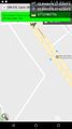
Got it! @55.8991,37.4233

Achievements