2018-04-14 49 19
| Sat 14 Apr 2018 in 49,19: 49.7832175, 19.1991100 geohashing.info google osm bing/os kml crox |
Location
A tavern(?) at Międzybrodzkie Lake.

According to Google Maps, today's coordinates fall in the grassy yard of a private-owned guesthouse/tavern/mooring at the shore of Międzybrodzkie Lake within the limits of Międzybrodzie Bialskie village. It looks like a nice place.
Participants
- Malgond
- his family.
Plans
Go there by car, have a nice afternoon at the lake and maybe a snack at the tavern (if it turns out any good).
Expedition
Sadly, this expedition was marked by failures and disappointments. Nevertheless, no failure prevents a dedicated geohasher from having a nice adventure even if it turns out not quite like planned.
Since it was Saturday, I originally planned to arrive there by hash o'clock to boost my pathetic centurion achievement just a little bit. I intended to set out at 2 p.m. to get there before 4 p.m. - but you know how it goes with kids. In the end we set out at a quarter to four. Our planned route led us south along the dual-carriage road towards Zakopane, then west along route 52 towards Bielsko-Biała, the "capital" of the graticule. We've passed the towns of Kalwaria Zebrzydowska, Wadowice and Andrychów and turned south towards Porąbka and Międzybrodzie Bialskie, our destination.
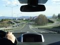
On the route 7 near Mogilany.
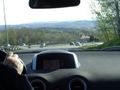
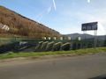
The road through the hills.
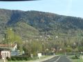
Approaching Kalwaria Zebrzydowska. Bernardines Monastery on the hill.
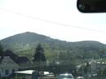
The hills turned into mountains.
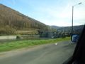
Crossing Soła river on a narrow one-lane bridge.
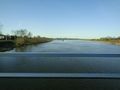
The dam of the Międzybrodzkie Lake.
The dam close-up.
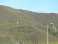
High-voltage pylons on the side of the Żar Mountain...
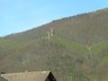
...leading to the pumped-storage hydroelectric plant.
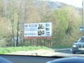
Our destination.


Achievements