Difference between revisions of "2018-04-27 47 -122"
From Geohashing
imported>Thomcat ([live picture]Location [http://www.openstreetmap.org/?lat=47.77975560&lon=-122.38121340&zoom=16&layers=B000FTF @47.7798,-122.3812]) |
imported>Thomcat ([live picture]Leaving Woodway [http://www.openstreetmap.org/?lat=47.77810640&lon=-122.38279920&zoom=16&layers=B000FTF @47.7781,-122.3828]) |
||
| Line 45: | Line 45: | ||
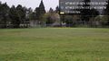
Image:2018-04-27_47_-122_thomcat_1524844649744.jpg|Location [http://www.openstreetmap.org/?lat=47.77975560&lon=-122.38121340&zoom=16&layers=B000FTF @47.7798,-122.3812] | Image:2018-04-27_47_-122_thomcat_1524844649744.jpg|Location [http://www.openstreetmap.org/?lat=47.77975560&lon=-122.38121340&zoom=16&layers=B000FTF @47.7798,-122.3812] | ||
| + | |||
| + | Image:2018-04-27_47_-122_thomcat_1524844754876.jpg|Leaving Woodway [http://www.openstreetmap.org/?lat=47.77810640&lon=-122.38279920&zoom=16&layers=B000FTF @47.7781,-122.3828] | ||
</gallery> | </gallery> | ||
Revision as of 15:59, 27 April 2018
| Fri 27 Apr 2018 in 47,-122: 47.7798101, -122.3812259 geohashing.info google osm bing/os kml crox |
Location
Participants
Plans
Expedition
Tracklog
Photos
Hillwood park & playfield @47.7676,-122.3634

Geohasher @47.7798,-122.3812
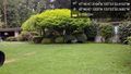
Location @47.7798,-122.3812
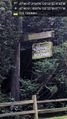
Leaving Woodway @47.7781,-122.3828


Achievements