Difference between revisions of "2020-02-23 53 -2"
m (→Photos & Video: add photos) |
m (→Photos & Video: add photos) |
||
| Line 25: | Line 25: | ||
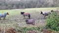
Image:2020-02-23 53 -2 Geese.jpg|Uh oh. They have <strike>geese</strike> dinosaurs guarding the hashpoint. | Image:2020-02-23 53 -2 Geese.jpg|Uh oh. They have <strike>geese</strike> dinosaurs guarding the hashpoint. | ||
Image:2020-02-23 53 -2 Cone.jpg|OK, I guess I won't be reaching the hashpoint that way. Still, there are plenty of other ways around to it, right? | Image:2020-02-23 53 -2 Cone.jpg|OK, I guess I won't be reaching the hashpoint that way. Still, there are plenty of other ways around to it, right? | ||
| + | Image:2020-02-23 53 -2 GPS first.png|So this is as close as I'm getting this way. And, as it would turn out, any way. | ||
| + | Image:2020-02-23 53 -2 Stream pano 1.jpg|So that stream is right between me and the hashpoint. And the path to the left is also blocked off. But there must be some way over or around it, right? | ||
| + | Image:2020-02-23 53 -2 Bower.jpg|Perhaps this is a conveniently located portal to the hashpoint? | ||
| + | Image:2020-02-23 53 -2 Bower isle.jpg|No, that's definitely a dead end. | ||
| + | Image:2020-02-23 53 -2 Bower pano.jpg|There's only one way back and out from here. I'll see where I can go from there. | ||
</gallery> | </gallery> | ||
Revision as of 19:46, 23 February 2020
| Sun 23 Feb 2020 in Manchester, UK: 53.3868933, -2.0434446 geohashing.info google osm bing/os kml crox |
Contents
Location
The hashpoint for today is in the wood near a golf course by Marple. I believe it's within the borders of the Roman Lakes Leisure Park. No admission fee, so no Admit One achievement. There are streams in the area, but there seems to be a bit of the path on the right side of the streams to reach the hashpoint.
Participants
Plans
KarMann is going to catch a bus to get there around 13:50, but the last couple of hundred metres may be treacherous.
Photos & Video
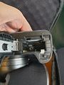
Not an auspicious start. I forgot to bring the SD card for my camera. It and the tripod are now just dead weight I'm going to have to lug around with me.
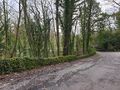
But this does look rather nice. This just might be a lovely walk in the woods today.
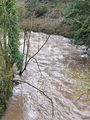
Oh my. That stream does look rather swollen and rough, doesn't it?
Are you sure there isn't a 'my kingdom for a horse' consolation prize? Not even anything about battery staples?
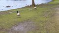
Uh oh. They have
geesedinosaurs guarding the hashpoint.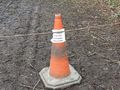
OK, I guess I won't be reaching the hashpoint that way. Still, there are plenty of other ways around to it, right?
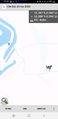
So this is as close as I'm getting this way. And, as it would turn out, any way.
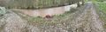
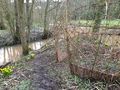
So that stream is right between me and the hashpoint. And the path to the left is also blocked off. But there must be some way over or around it, right?
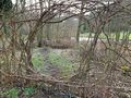
Perhaps this is a conveniently located portal to the hashpoint?
No, that's definitely a dead end.
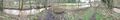
There's only one way back and out from here. I'll see where I can go from there.


