Difference between revisions of "2020-02-28 53 -1"
From Geohashing
m (→Participants: tweak wording) |
(→Photos: add photos) |
||
| Line 34: | Line 34: | ||
--> | --> | ||
<gallery perrow="5"> | <gallery perrow="5"> | ||
| + | Image:2020-02-28 53 -1 Agricultural access.jpg | Our first warning sign, if somewhat ambiguous as to its interpretation. | ||
| + | Image:2020-02-28 53 -1 Slope.jpg | A steep, wet, and snowy climb to the residence nearest the hashpoint. | ||
| + | Image:2020-02-28 53 -1 Cock.jpg | Another hashpoint guarded by dinosaurs. | ||
| + | Image:2020-02-28 53 -1 Sad face.jpg | Sad KarMann was sad upon realising we wouldn't be reaching this hashpoint today. | ||
</gallery> | </gallery> | ||
Revision as of 13:02, 2 March 2020
| Fri 28 Feb 2020 in 53,-1: 53.4050773, -1.7840553 geohashing.info google osm bing/os kml crox |
Location
A clearing in the wood along Snake Pass.
Participants
- KarMann
- KarMann's wife
Plans
Find parking somewhere along Snake Road and walk a couple of hundred metres to the hashpoint.
Expedition
Tracklog
Photos
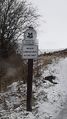
Our first warning sign, if somewhat ambiguous as to its interpretation.
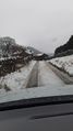
A steep, wet, and snowy climb to the residence nearest the hashpoint.
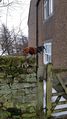
Another hashpoint guarded by dinosaurs.

Sad KarMann was sad upon realising we wouldn't be reaching this hashpoint today.


Achievements