Difference between revisions of "2020-03-08 49 8"
(→Tracklog) |
(→Photos) |
||
| Line 38: | Line 38: | ||
Image:2020-##-## ## ## Alpha.jpg | Witty Comment | Image:2020-##-## ## ## Alpha.jpg | Witty Comment | ||
--> | --> | ||
| − | <gallery perrow=" | + | <gallery perrow="6"> |
| + | 2020-03-08 - proof of transport.jpg|proof of transport | ||
| + | 2020-03-08 - 25 m in there.jpg | 25 m in there | ||
| + | proof_2020_03_08.png|proof | ||
| + | 2020-03-08 - view to the north.jpg|view to the north | ||
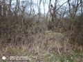
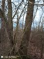
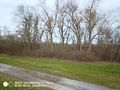
| + | 2020-03-08 - hash tree in the west.jpg|hash tree in the west | ||
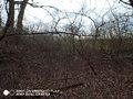
| + | 2020-03-08 - hash-tree in the east.jpg|hash-tree in the east | ||
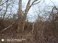
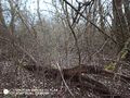
| + | 2020-03-08 - dead hash-tree in the south.jpg|dead hash tree | ||
| + | 2020-03-08 - stupid grin.jpg|stupid grin | ||
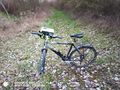
| + | 2020-03-08 - back at my bike.jpg| back at my bike | ||
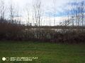
| + | 2020-03-08 - view along the dike.jpg|view along the dike | ||
| + | 2020-03-08 - view from dike to hash-thicket.jpg|view from dike to hash-thicket | ||
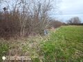
| + | 2020-03-08 - water on the other side.jpg|water on the other side | ||
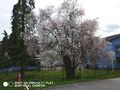
| + | 2020-03-08 - spring blossom.jpg|spring blossom on my way back | ||
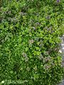
| + | 2020-03-08 - spring flowers.jpg|and spring flowers | ||
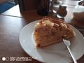
| + | 2020-03-08 - welcome back cake.jpg|welcome back cake | ||
| + | 2020-03-08 - and coffee.jpg| ...and coffee | ||
</gallery> | </gallery> | ||
Revision as of 16:47, 8 March 2020
| Sun 8 Mar 2020 in 49,8: 49.2683842, 8.4635700 geohashing.info google osm bing/os kml crox |
Location
Some bushes near the dike between Oberhausen and the river Rhine.
Participants
Plans
It's just an half an hour ride from home by bike. So I think I'll go there soon and arive around 2 pm.
Expedition
So, this was my first regular and successful hash after more than 400 days. But that's already the most spectacular part of the story.
I started a little later than expected , at almost 2 pm. After a nice ride through the city of Speyer, over the bridge and along the Rhine Ireached the thicket, that shelters todays hashpoint. On my way there were at least 10 stork's nests, and they were all inhabitated. So easy it was to get near the hash, so hard were the last 20 m. M yfirst approach led me 25 m to it, but it seemed almost impossible to get into the thicket. Maybe, it's easier from the other side? Well, it doesn't look easier, but it was at least only 18 m. So I tried from this side. Well, long story short, I fought myself into the thicket, and as usual it gets wider after the first 5 m. Some pictures later I had to get out again. I guess I needed more than 20 minutes for this 50m and was very happy when I was back at my bike.
On my way back I found out, that there was some wind, now from the rear, that made the way home much faster than the way there. And, of course, a successful hash has to be celebrated :-)
Tracklog
Photos
proof of transport
25 m in there

proof
view to the north
hash tree in the west
hash-tree in the east
dead hash tree

stupid grin
back at my bike
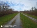
view along the dike
view from dike to hash-thicket
water on the other side
spring blossom on my way back
and spring flowers
welcome back cake

...and coffee


Achievements