2020-06-01 60 27
From Geohashing
| Mon 1 Jun 2020 in 60,27: 60.5196608, 27.4169487 geohashing.info google osm bing/os kml crox |
Location
Participants
Plans
Expedition
Tracklog
Photos
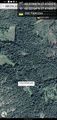
Surprisingly close by car @60.5216,27.4168
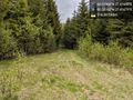
The road was quite small though @60.5216,27.4168
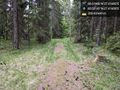
Rest of the way at first at least road-ish, but not drivable. @60.5214,27.4161


Achievements