Difference between revisions of "2020-07-04 48 -119"
From Geohashing
([live picture]Dam [https://openstreetmap.org/?lat=47.94657340&lon=-118.99319940&zoom=16&layers=B000FTF @47.9466,-118.9932]) |
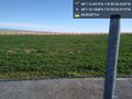
([live picture]close [https://openstreetmap.org/?lat=48.01947410&lon=-119.50747700&zoom=16&layers=B000FTF @48.0195,-119.5075]) |
||
| Line 36: | Line 36: | ||
Image:2020-07-04_48_-119_thomcat_1593871574868.jpg|Dam [https://openstreetmap.org/?lat=47.94657340&lon=-118.99319940&zoom=16&layers=B000FTF @47.9466,-118.9932] | Image:2020-07-04_48_-119_thomcat_1593871574868.jpg|Dam [https://openstreetmap.org/?lat=47.94657340&lon=-118.99319940&zoom=16&layers=B000FTF @47.9466,-118.9932] | ||
| + | |||
| + | Image:2020-07-04_48_-119_thomcat_1593874969115.jpg|close [https://openstreetmap.org/?lat=48.01947410&lon=-119.50747700&zoom=16&layers=B000FTF @48.0195,-119.5075] | ||
</gallery> | </gallery> | ||
Revision as of 15:03, 4 July 2020
| Sat 4 Jul 2020 in 48,-119: 48.0200255, -119.5078956 geohashing.info google osm bing/os kml crox |
Location
Participants
Plans
Expedition
Tracklog
Photos
close @48.0195,-119.5075


Achievements