Difference between revisions of "2021-02-18 47 -122"
From Geohashing
([live picture]Geohasher [https://openstreetmap.org/?lat=47.64647680&lon=-122.34926230&zoom=16&layers=B000FTF @47.6465,-122.3493]) |
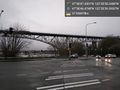
([live picture]Bridge [https://openstreetmap.org/?lat=47.64741210&lon=-122.35052830&zoom=16&layers=B000FTF @47.6474,-122.3505]) |
||
| Line 44: | Line 44: | ||
Image:2021-02-18_47_-122_thomcat_1613698487669.jpg|Geohasher [https://openstreetmap.org/?lat=47.64647680&lon=-122.34926230&zoom=16&layers=B000FTF @47.6465,-122.3493] | Image:2021-02-18_47_-122_thomcat_1613698487669.jpg|Geohasher [https://openstreetmap.org/?lat=47.64647680&lon=-122.34926230&zoom=16&layers=B000FTF @47.6465,-122.3493] | ||
| + | |||
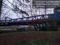
| + | Image:2021-02-18_47_-122_thomcat_1613698602320.jpg|Bridge [https://openstreetmap.org/?lat=47.64741210&lon=-122.35052830&zoom=16&layers=B000FTF @47.6474,-122.3505] | ||
</gallery> | </gallery> | ||
Revision as of 01:36, 19 February 2021
| Thu 18 Feb 2021 in 47,-122: 47.6465083, -122.3495135 geohashing.info google osm bing/os kml crox |
Location
Participants
Plans
Expedition
Tracklog
Photos
Waiting @47.6462,-122.3498
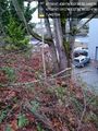
Tree? @47.6464,-122.3495
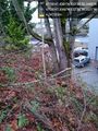
Tree @47.6465,-122.3495
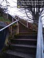
Stairs @47.6465,-122.3495

Geohasher @47.6465,-122.3493
Bridge @47.6474,-122.3505


Achievements