2021-03-28 47 -122
From Geohashing
| Sun 28 Mar 2021 in 47,-122: 47.7962037, -122.1414554 geohashing.info google osm bing/os kml crox |
Location
Participants
Plans
Expedition
Tracklog
Photos
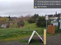
Parked @47.7918,-122.1420
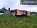
Brightwater @47.7935,-122.1419
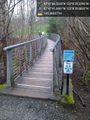
Bridges & wetlands @47.7949,-122.1416


Achievements