Difference between revisions of "2021-07-28 39 -77"
From Geohashing
([live picture]The actual spot is about 200 ft into that cornfield [https://openstreetmap.org/?lat=39.29635040&lon=-77.46931210&zoom=16&layers=B000FTF @39.2964,-77.4693]) |
([live picture]Made it (more or less) [https://openstreetmap.org/?lat=39.29634430&lon=-77.46932490&zoom=16&layers=B000FTF @39.2963,-77.4693]) |
||
| Line 36: | Line 36: | ||
Image:2021-07-28_39_-77_OfficeLinebacker_1627500421866.jpg|The actual spot is about 200 ft into that cornfield [https://openstreetmap.org/?lat=39.29635040&lon=-77.46931210&zoom=16&layers=B000FTF @39.2964,-77.4693] | Image:2021-07-28_39_-77_OfficeLinebacker_1627500421866.jpg|The actual spot is about 200 ft into that cornfield [https://openstreetmap.org/?lat=39.29635040&lon=-77.46931210&zoom=16&layers=B000FTF @39.2964,-77.4693] | ||
| + | |||
| + | Image:2021-07-28_39_-77_OfficeLinebacker_1627500493493.jpg|Made it (more or less) [https://openstreetmap.org/?lat=39.29634430&lon=-77.46932490&zoom=16&layers=B000FTF @39.2963,-77.4693] | ||
</gallery> | </gallery> | ||
Revision as of 19:28, 28 July 2021
| Wed 28 Jul 2021 in 39,-77: 39.2964013, -77.4702443 geohashing.info google osm bing/os kml crox |
Location
Participants
Plans
Expedition
Tracklog
Photos
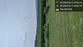
The actual spot is about 200 ft into that cornfield @39.2964,-77.4693

Made it (more or less) @39.2963,-77.4693


Achievements