Difference between revisions of "2022-02-27 42 -72"
Cibachrome (talk | contribs) (→Photos) |
Cibachrome (talk | contribs) (→Photos) |
||
| Line 39: | Line 39: | ||
<gallery perrow="5"> | <gallery perrow="5"> | ||
Image:2022-02-27_42_-72_Cibachrome_1.png | Google Maps screenshot! | Image:2022-02-27_42_-72_Cibachrome_1.png | Google Maps screenshot! | ||
| − | Image:2022-02-27_42_-72_Cibachrome_2. | + | Image:2022-02-27_42_-72_Cibachrome_2.png | One of the comically many posted signs along this road. If the hashpoint were further from the road I would have had to abandon |
| − | Image:2022-02-27_42_-72_Cibachrome_3. | + | Image:2022-02-27_42_-72_Cibachrome_3.png | A view of the scenery visible from 2022-02-27 42 -72 |
| − | Image:2022-02-27_42_-72_Cibachrome_4. | + | Image:2022-02-27_42_-72_Cibachrome_4.png | it me |
</gallery> | </gallery> | ||
Revision as of 16:47, 27 February 2022
| Sun 27 Feb 2022 in 42,-72: 42.9300790, -72.3497674 geohashing.info google osm bing/os kml crox |
Location
Along Grimes Rd., a small road on the outskirts of Keene, New Hampshire
Participants
Cibachrome Cibachrome's Dad
Plans
I was already headed out that way today with my dad, so the plan was to bother him to drive to the hashpoint (easily accessible, on a road near where we were for once!).
Expedition
After tending to some errands etc, we found our way to Grimes Rd. There was some concern that it would be a private road, or that we would otherwise not be able to reach the point, but everything went great. I stepped out of the car, walked to the point, which was in fact right on the road, waved my phone in the air until I got a good reading, walked along the road for a bit just to account for any error in the GPS reading, then got back in the car and left.
Photos
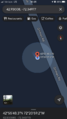
Google Maps screenshot!
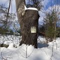
One of the comically many posted signs along this road. If the hashpoint were further from the road I would have had to abandon
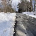
A view of the scenery visible from 2022-02-27 42 -72
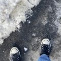
it me


Achievements