Difference between revisions of "2022-07-09 47 -118"
From Geohashing
([live picture]Road [https://openstreetmap.org/?mlat=47.22628397&mlon=-119.63460897&zoom=16 @47.2263,-119.6346]) |
([live picture]Gate [https://openstreetmap.org/?mlat=47.34336400&mlon=-118.91517500&zoom=16 @47.3434,-118.9152]) |
||
| Line 30: | Line 30: | ||
Image:2022-07-09_47_-118_thomcat_1657395225382.jpg|Road [https://openstreetmap.org/?mlat=47.22628397&mlon=-119.63460897&zoom=16 @47.2263,-119.6346] | Image:2022-07-09_47_-118_thomcat_1657395225382.jpg|Road [https://openstreetmap.org/?mlat=47.22628397&mlon=-119.63460897&zoom=16 @47.2263,-119.6346] | ||
| + | |||
| + | Image:2022-07-09_47_-118_thomcat_1657399596318.jpg|Gate [https://openstreetmap.org/?mlat=47.34336400&mlon=-118.91517500&zoom=16 @47.3434,-118.9152] | ||
</gallery> | </gallery> | ||
Revision as of 20:46, 9 July 2022
| Sat 9 Jul 2022 in Davenport: 47.3455309, -118.9183977 geohashing.info google osm bing/os kml crox |
Location
West of Odessa on highway 28.
Participants
Plans
Quick stop on eastward journey to camping.
Expedition
Tracklog
Photos
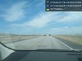
Road @47.2263,-119.6346
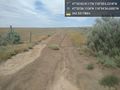
Gate @47.3434,-118.9152

