Difference between revisions of "2022-07-16 48 -118"
From Geohashing
([live picture]Trail [https://openstreetmap.org/?mlat=49.01779497&mlon=-118.22685597&zoom=16 @49.0178,-118.2269]) |
([live picture]Geohasher [https://openstreetmap.org/?mlat=48.99167597&mlon=-118.20542500&zoom=16 @48.9917,-118.2054]) |
||
| Line 42: | Line 42: | ||
Image:2022-07-16_48_-118_thomcat_1657991216748.jpg|Trail [https://openstreetmap.org/?mlat=49.01779497&mlon=-118.22685597&zoom=16 @49.0178,-118.2269] | Image:2022-07-16_48_-118_thomcat_1657991216748.jpg|Trail [https://openstreetmap.org/?mlat=49.01779497&mlon=-118.22685597&zoom=16 @49.0178,-118.2269] | ||
| + | |||
| + | Image:2022-07-16_48_-118_thomcat_1657991753582.jpg|Geohasher [https://openstreetmap.org/?mlat=48.99167597&mlon=-118.20542500&zoom=16 @48.9917,-118.2054] | ||
</gallery> | </gallery> | ||
Revision as of 17:16, 16 July 2022
| Sat 16 Jul 2022 in 48,-118: 48.9917831, -118.2057052 geohashing.info google osm bing/os kml crox |
Location
Participants
Plans
Expedition
Tracklog
Photos
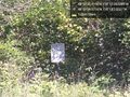
Border sign @48.9999,-118.2172
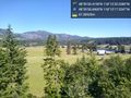
Up the hill @48.9919,-118.2048
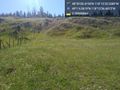
Fence @48.9923,-118.2041
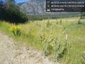
Trail @49.0178,-118.2269

Geohasher @48.9917,-118.2054


Achievements