Difference between revisions of "2023-03-22 42 -70"
From Geohashing
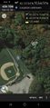
([live picture]The lake nearby, also in the dark. [https://openstreetmap.org/?mlat=42.15820300&mlon=-70.84629050&zoom=16 @42.1582,-70.8463]) |
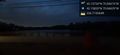
([live picture]Sign, providing further proof. Light held by dauntless fellow participant. [https://openstreetmap.org/?mlat=42.15806000&mlon=-70.84608970&zoom=16 @42.1581,-70.8461]) |
||
| Line 41: | Line 41: | ||
Image:2023-03-22_42_-70_JesseFTW_1679538664720.jpg|The lake nearby, also in the dark. [https://openstreetmap.org/?mlat=42.15820300&mlon=-70.84629050&zoom=16 @42.1582,-70.8463] | Image:2023-03-22_42_-70_JesseFTW_1679538664720.jpg|The lake nearby, also in the dark. [https://openstreetmap.org/?mlat=42.15820300&mlon=-70.84629050&zoom=16 @42.1582,-70.8463] | ||
| + | |||
| + | Image:2023-03-22_42_-70_JesseFTW_1679538723321.jpg|Sign, providing further proof. Light held by dauntless fellow participant. [https://openstreetmap.org/?mlat=42.15806000&mlon=-70.84608970&zoom=16 @42.1581,-70.8461] | ||
</gallery> | </gallery> | ||
Revision as of 02:32, 23 March 2023
| Wed 22 Mar 2023 in 42,-70: 42.1573417, -70.8467402 geohashing.info google osm bing/os kml crox |
Location
Participants
Plans
Expedition
- Made it, more or less, a bit after dark. I didn't want to go walking in the woods in the dark, so the closest I got was about 100 feet. But it was still neat! -- JesseFTW (talk) 22:29, 22 March 2023 (EDT)
Tracklog
Photos
Proof, although without the Silly Grin.
The woods, in the dark. @42.1577,-70.8464
The lake nearby, also in the dark. @42.1582,-70.8463

Sign, providing further proof. Light held by dauntless fellow participant. @42.1581,-70.8461


Achievements