Difference between revisions of "2023-10-17 47 -122"
From Geohashing
([live picture]North of point [https://openstreetmap.org/?mlat=47.81224870&mlon=-122.27994600&zoom=16 @47.8122,-122.2799]) |
([live picture]A stream runs through it [https://openstreetmap.org/?mlat=47.81221670&mlon=-122.28011510&zoom=16 @47.8122,-122.2801]) |
||
| Line 35: | Line 35: | ||
Image:2023-10-17_47_-122_thomcat_1697562419234.jpg|North of point [https://openstreetmap.org/?mlat=47.81224870&mlon=-122.27994600&zoom=16 @47.8122,-122.2799] | Image:2023-10-17_47_-122_thomcat_1697562419234.jpg|North of point [https://openstreetmap.org/?mlat=47.81224870&mlon=-122.27994600&zoom=16 @47.8122,-122.2799] | ||
| + | |||
| + | Image:2023-10-17_47_-122_thomcat_1697562485049.jpg|A stream runs through it [https://openstreetmap.org/?mlat=47.81221670&mlon=-122.28011510&zoom=16 @47.8122,-122.2801] | ||
</gallery> | </gallery> | ||
Revision as of 17:08, 17 October 2023
| Tue 17 Oct 2023 in 47,-122: 47.8120758, -122.2798473 geohashing.info google osm bing/os kml crox |
Location
Participants
Plans
Expedition
Tracklog
Photos
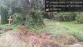
North of point @47.8122,-122.2799
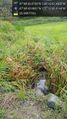
A stream runs through it @47.8122,-122.2801


Achievements