Difference between revisions of "2024-02-01 49 8"
Gefrierbrand (talk | contribs) ([live picture]proof) |
m |
||
| Line 1: | Line 1: | ||
| − | + | {{meetup graticule | |
| − | |||
| − | |||
| − | |||
| − | |||
| − | |||
| − | |||
| − | |||
| − | |||
| lat=49 | | lat=49 | ||
| lon=8 | | lon=8 | ||
| Line 13: | Line 5: | ||
}}<!-- edit as necessary --> | }}<!-- edit as necessary --> | ||
== Location == | == Location == | ||
| − | + | On a seemingly boring filed near Dieburg. | |
== Participants == | == Participants == | ||
| − | + | *[[User:Gefrierbrand|Gefrierbrand]] | |
| − | + | *[[User:Santu|Santu]] | |
| + | *Pedro the dog | ||
== Plans == | == Plans == | ||
| − | + | As Santu spotted a model airplane in a tree right on the route some days ago, the decision was easily made: We go geohashing and try to revocer the plane. | |
== Expedition == | == Expedition == | ||
| − | + | We packed an extendable ladder and pull-out branch shears and went of towards Zeilhard, where near the quarry the plane was still up in the tree awaiting rescue. After a quick check of the situation (thick thorny bushes and a steep slope) we started our attempt. Santu went up the ladder and then climbed the tree like a squirrel. As the plane was quite far away from the stem and Gefrierbrand already mildly alarmed by the height of Santu's climbing the pull-out shears came into action. With the help of some gentle force the plane let go of its wings and spun towards the ground. A nerve-racking and slightly slower descent later, Santu had firm ground under her feet and we packed all the parts and went on towards the hash. | |
| + | It was already dark when we left the car and entered the forest. Following a broad path, the three of us were positive to have an easy job on this one. Far from it! First we stood in front of a creek, so we had to find a way around. We found one, but at the cost of warm feet. The whole field was flooded and Gefrierbrand and Pedro got quite wet and cold feet. With wise foresight Santu wore her Wellies and was lucky. | ||
| + | Finaly we managed to get to the hash, which was right at the edge of the field among some old trees. | ||
== Tracklog == | == Tracklog == | ||
Revision as of 20:58, 4 February 2024
| Thu 1 Feb 2024 in 49,8: 49.8889435, 8.8175465 geohashing.info google osm bing/os kml crox |
Location
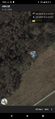
On a seemingly boring filed near Dieburg.
Participants
- Gefrierbrand
- Santu
- Pedro the dog
Plans
As Santu spotted a model airplane in a tree right on the route some days ago, the decision was easily made: We go geohashing and try to revocer the plane.
Expedition
We packed an extendable ladder and pull-out branch shears and went of towards Zeilhard, where near the quarry the plane was still up in the tree awaiting rescue. After a quick check of the situation (thick thorny bushes and a steep slope) we started our attempt. Santu went up the ladder and then climbed the tree like a squirrel. As the plane was quite far away from the stem and Gefrierbrand already mildly alarmed by the height of Santu's climbing the pull-out shears came into action. With the help of some gentle force the plane let go of its wings and spun towards the ground. A nerve-racking and slightly slower descent later, Santu had firm ground under her feet and we packed all the parts and went on towards the hash. It was already dark when we left the car and entered the forest. Following a broad path, the three of us were positive to have an easy job on this one. Far from it! First we stood in front of a creek, so we had to find a way around. We found one, but at the cost of warm feet. The whole field was flooded and Gefrierbrand and Pedro got quite wet and cold feet. With wise foresight Santu wore her Wellies and was lucky. Finaly we managed to get to the hash, which was right at the edge of the field among some old trees.
Tracklog
Photos
proof

Achievements