Category:Maps
From Geohashing
Media in category "Maps"
The following 200 files are in this category, out of 608 total.
(previous page) (next page) Austin.png 363 × 422; 237 KB
 Australia map.png 563 × 476; 8 KB
 Australian Capital Territory locator-MJC.png 563 × 476; 13 KB
 Australian Graticules.png 978 × 943; 358 KB
 Bad Salzdetfurth regional.svg 486 × 400; 9 KB
 Badbergen regional.svg 486 × 400; 6 KB
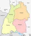 Governmental Districts of Baden-Württemberg.png 1,000 × 1,130; 247 KB
 Ballaraticule failures.jpg 3,014 × 3,725; 979 KB
 Governmental Districts of Bavaria.png 1,000 × 986; 322 KB
 BaWue district map ekorren.png 575 × 624; 174 KB
 Benjw geomap.png 216 × 290; 3 KB
 Benjw hashmap 2.png 640 × 575; 87 KB
 Benjw hashmap.png 640 × 575; 131 KB
 Berlin regional.svg 245 × 400; 104 KB
 Bezirke.gif 972 × 1,119; 226 KB
 Bielefeld regional.svg 126 × 400; 88 KB
 Boston06-24-08 GMaps.jpg 249 × 250; 42 KB
 Bramsche regional.svg 486 × 400; 10 KB
 Brandenburg regional.svg 325 × 400; 387 KB
 Cities of Bremen.png 1,000 × 1,303; 133 KB
 Bremen regional.svg 240 × 400; 61 KB
 Brisbane, Australia.png 482 × 400; 65 KB
 Quarters of Buchholz-Kleefeld.png 642 × 774; 85 KB
- Error creating thumbnail: Unable to save thumbnail to destinationBump-polar.jpg 675 × 660; 111 KB
- Error creating thumbnail: Unable to save thumbnail to destinationBump-sat.jpg 850 × 600; 141 KB
 Bump.jpg 800 × 600; 120 KB
 Bump2.jpg 638 × 600; 98 KB
 Burgdorf regional.svg 486 × 400; 7 KB
 Calamus penta.png 434 × 699; 441 KB
 Calgary-centred.png 300 × 400; 31 KB
 Cg map 2011-10-15.jpg 1,000 × 742; 799 KB
 Charfa regio.png 232 × 194; 1 KB
 Chicago semigraticule.png 545 × 731; 108 KB
 Cloppenburg regional.svg 486 × 400; 5 KB
 Close-to-work.jpg 1,024 × 530; 146 KB
 Coburg.svg 508 × 400; 33 KB
 Columbus Graticules.png 730 × 953; 138 KB
 David Miller Geohash Points.png 951 × 600; 582 KB
 DavidMiller - 2009-11-03 - 51 -1 - Hash Journey.jpg 4,640 × 1,062; 1.23 MB
 DavidMillers Hash Points.jpg 610 × 416; 60 KB
 Dawidi-ExpeditionGraticules-2009-01-25.png 360 × 224; 11 KB
 Dawidi-ExpeditionGraticules.jpg 1,450 × 1,381; 114 KB
 DC Super Grat.png 393 × 499; 126 KB
 DCN FloridaCounties.png 3,014 × 2,329; 555 KB
 DCN FloridaMinesweeper.png 184 × 210; 1 KB
 Decicule.png 400 × 399; 112 KB
 Denver grat.jpg 729 × 952; 149 KB
 Districts of Regierungsbezirk Detmold.png 1,000 × 1,238; 196 KB
 District of Columbia Graticules.png 730 × 467; 346 KB
 Districts EU-DE ekorren.png 1,650 × 2,067; 907 KB
 Districts EU-DE-BY.png 643 × 620; 148 KB
 Districts EU-DE.png 1,650 × 2,067; 266 KB
 DODO 2014-05-01 Administrative 49 8-Level 0.jpg 635 × 956; 281 KB
 DODO 2014-05-01 Administrative 49 8-Level 1.jpg 647 × 945; 286 KB
 DODO 2014-05-01 Administrative 49 8-Level 2.jpg 645 × 952; 284 KB
 DODO 2014-05-01 Administrative 49 8-Level 3.jpg 651 × 960; 288 KB
 DODO 2014-11 Level0.png 449 × 953; 767 KB
 DODO 2014-11 Level1.png 456 × 946; 784 KB
 DODO 2014-11 Level2.png 436 × 948; 746 KB
 DODO 2014-11 Level3.png 446 × 939; 777 KB
 DODO 2014-12 Level0.png 450 × 969; 889 KB
 DODO 2014-12 Level1.png 461 × 974; 931 KB
 DODO 2014-12 Level2.png 440 × 957; 870 KB
 DODO 2014-12 Level3.png 442 × 967; 907 KB
 DODO-Level 0-2014-06-30.png 567 × 984; 1.07 MB
 DODO-Level 1-2014-06-30.png 538 × 977; 1.01 MB
 DODO-Level 2-2014-06-30.png 532 × 979; 1,006 KB
 DODO-Level 3-2014-06-30.png 543 × 975; 1,002 KB
 Downtown Pittsburgh.png 825 × 363; 238 KB
 Dtobias-birthplace-graticule-line.png 616 × 442; 89 KB
 Ekorren visited graticules.png 232 × 242; 3 KB
 Equidistant World Map.gif 517 × 263; 5 KB
 Essen (Oldenburg) regional.svg 486 × 400; 8 KB
 Europakarte-2014-09-RecentlyChanged.png 800 × 600; 171 KB
 Europe-visited-graticules.png 1,560 × 738; 20 KB
 Expeditions 5tof.png 801 × 610; 850 KB
 Geco screenshot.png 408 × 421; 115 KB
 Gehrde regional.svg 486 × 400; 4 KB
 Geohash-45-93-20080531-map.jpg 622 × 361; 139 KB
 Geohash-ponedelnik-dolna-mahala.jpg 1,164 × 1,332; 302 KB
 Geohash20100118 50 11 1.png 459 × 386; 411 KB
 Geohashing info v2.png 906 × 473; 634 KB
 Geomap 2013-03-22.png 500 × 500; 73 KB
 Geomap-vb.png 500 × 500; 98 KB
 Geomap.png 500 × 500; 62 KB
 Geosplashing.png 244 × 237; 39 KB
 Districts of the German Democratic Republic.png 1,000 × 1,277; 411 KB
 Catholic Dioceses of Germany.png 1,173 × 1,558; 270 KB
 Protestant Landeskirchen of Germany.png 1,000 × 1,292; 152 KB
 States of Germany.png 1,000 × 1,185; 394 KB
 States of the Weimar Republic.png 2,000 × 1,676; 667 KB
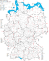
 Germany regional.png 3,050 × 4,000; 302 KB
 Germany regional.svg 0 × 0; 4.34 MB
 GHash for iPhone (work in progress).jpg 750 × 1,334; 149 KB
 Ghcsugg.png 1,155 × 703; 254 KB
 Globalhash-at-a-glance-example.png 512 × 512; 72 KB
 Globalhash-at-a-glance.png 1,201 × 1,201; 208 KB
 GMaps.Geohash.06-06-2008.Boston.jpg 200 × 160; 12 KB
 GMaps.Geohash.06-19-2008.Boston.jpg 400 × 400; 69 KB
 GMaps.Geohash.06-96-2008.Boston.jpg 400 × 400; 69 KB
 Gps.png 1,283 × 782; 1.8 MB
 Grat.png 467 × 399; 106 KB
 Graticule 52 0 Map.jpg 2,910 × 4,783; 5.22 MB
 Half-grat.png 316 × 189; 2 KB
 Hamburg regional.svg 711 × 400; 61 KB
 Municipalities of Landkreis Hameln-Pyrmont.png 1,000 × 1,020; 173 KB
 Hand of EoGL.jpg 1,280 × 720; 269 KB
 Municipalities of the Hannover Region.png 1,000 × 837; 262 KB
 Harsum regional.svg 486 × 400; 6 KB
 Hasbergen regional.svg 486 × 400; 11 KB
 HaschelOregon.png 200 × 194; 2 KB
 Hash-Wien-2015-04-08-moreproof.png 768 × 1,280; 96 KB
 Hash0526.jpg 443 × 407; 43 KB
 Hashpoint1022.jpg 1,044 × 607; 86 KB
 Hashpoints 23 10 2009 DavidMiller.JPG 931 × 692; 87 KB
 Hedge-end-recreation-ground.png 557 × 500; 564 KB
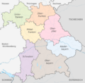
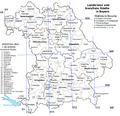
 Governmental Districts of Hessen.png 1,000 × 1,341; 240 KB
 Municipalities of Landkreis Hildesheim.png 1,000 × 1,000; 247 KB
 Ilpadre hashpoints visited.png 594 × 819; 234 KB
 Ilpadre HD Stadtteile neu.png 984 × 731; 415 KB
 Ilpadre HD Stadtteile.png 984 × 731; 415 KB
 Image-New South Wales locator-MJC.png 563 × 476; 12 KB
 Image.jpg 640 × 1,136; 97 KB
 IMGP0011.JPG 800 × 600; 104 KB
 Interactive Map.png 1,273 × 1,012; 231 KB
 Irish sea.jpg 461 × 561; 84 KB
 Israelmap.jpg 186 × 426; 21 KB
 Istanbul.jpg 414 × 347; 78 KB
 Jand geomap as of 8-10-12.png 500 × 500; 64 KB
 Jand Geomap.png 500 × 500; 98 KB
 Jburg.png 445 × 285; 73 KB
 Johnwrw zoomed out map.png 320 × 480; 167 KB
 Jrk geo.jpg 344 × 301; 43 KB
 July30-2008Hash.JPG 827 × 618; 78 KB
 Karttapaikka.jpg 606 × 605; 68 KB
 KatieWheatleys-geohashing-points.PNG 828 × 484; 354 KB
 Kekerengu regional-gh-proposal a.PNG 300 × 300; 9 KB
 Kekerengu regional-gh-proposal.PNG 300 × 300; 9 KB
 KerrMcF 55 -3 Regions.svg 228 × 400; 256 KB
 KerrMcF 56 -3 Regions.svg 223 × 400; 271 KB
 KerrMcF Falkirk Regions.svg 225 × 400; 31 KB
 KerrMcF Fife Regions.svg 441 × 400; 257 KB
 KerrMcF Inverclyde Regions.svg 228 × 400; 54 KB
 KerrMcF North Ayrshire Regions.svg 453 × 400; 398 KB
 KerrMcF Stirling Regions.svg 225 × 400; 65 KB
 KerrMcF West Dunbartonshire Regions.svg 115 × 400; 16 KB
 KML Generator - Google Earth screen shot 1.jpg 683 × 885; 168 KB
 Kokonutty09 GeoHashingIphoneApp.jpg 334 × 480; 82 KB
 Kreis Borken regional.svg 248 × 400; 126 KB
 Kreis Gütersloh regional.svg 126 × 400; 91 KB
 Kreis Höxter regional.svg 497 × 400; 85 KB
 Kreis Lippe regional.svg 248 × 400; 144 KB
 Kreis Minden-Lübbecke regional.svg 486 × 400; 88 KB
 Kreis Pinneberg regional.svg 353 × 400; 57 KB
 Kreis Steinfurt regional.svg 248 × 400; 72 KB
 Kreis Warendorf regional.svg 248 × 400; 80 KB
 Lachiegeomap.png 500 × 500; 71 KB
 Lambertville artifact.png 887 × 729; 439 KB
 Land Geohash Proof.jpg 939 × 633; 92 KB
 Landkreis Ammerland regional.svg 475 × 400; 29 KB
 Landkreis Celle regional.svg 486 × 400; 42 KB
 Landkreis Cloppenburg regional.svg 242 × 400; 55 KB
 Landkreis Cuxhaven regional.svg 475 × 400; 60 KB
 Landkreis Diepholz regional.svg 242 × 400; 58 KB
 Landkreis Friesland regional.svg 475 × 400; 50 KB
 Landkreis Goslar regional.svg 126 × 400; 71 KB
 Landkreis Grafschaft Bentheim regional.svg 486 × 400; 57 KB
 Landkreis Göttingen regional.svg 497 × 400; 119 KB
 Landkreis Hameln-Pyrmont regional.svg 126 × 400; 66 KB
 Landkreis Harburg regional.svg 475 × 400; 49 KB
 Landkreis Havelland regional.svg 486 × 400; 70 KB
 Landkreis Heidekreis regional.svg 242 × 400; 74 KB
 Landkreis Helmstedt regional.svg 486 × 400; 55 KB
 Landkreis Hildesheim regional.svg 248 × 400; 53 KB
 Landkreis Holzminden regional.svg 126 × 400; 49 KB
 Landkreis Leer regional.svg 475 × 400; 45 KB
 Landkreis Lüchow-Dannenberg regional.svg 242 × 400; 52 KB
 Landkreis Nienburg regional.svg 486 × 400; 66 KB
 Landkreis Northeim regional.svg 497 × 400; 68 KB
 Landkreis Oldenburg regional.svg 123 × 400; 44 KB
 Landkreis Osnabrück regional.svg 486 × 400; 124 KB
 Landkreis Rotenburg (Wümme) regional.svg 242 × 400; 72 KB
 Landkreis Schaumburg regional.svg 486 × 400; 71 KB
 Landkreis Uelzen regional.svg 123 × 400; 31 KB
 Landkreis Verden regional.svg 242 × 400; 57 KB
 Lehrte regional.svg 486 × 400; 11 KB
 Districts of Lower Saxony.png 2,000 × 1,691; 771 KB
 Lucky geohash.PNG 407 × 530; 354 KB
 LuxMundi092309.jpg 800 × 472; 73 KB
 LuxMundi092509-1.jpg 800 × 472; 105 KB
 Lyxregio.png 232 × 242; 3 KB
 M5K Benton.jpg 222 × 299; 39 KB
 M5K Hood River.jpg 234 × 297; 71 KB
 M5K Jackson.jpg 284 × 300; 75 KB
 Macronencer 2020-03-13 Screenshot London Syzygy.png 511 × 403; 468 KB
 Macronencer 2020-03-14 Screenshot 180LON Russia.png 583 × 640; 706 KB
 Macronencer Geohashes01 001.png 333 × 277; 112 KB
 Macronencer Geohashes01 002.png 329 × 279; 111 KB
 Macronencer Geohashes01 003.png 432 × 271; 143 KB
 Macronencer Journal 2020-03-18 01.png 332 × 264; 161 KB


_regional.svg)


.jpg)


_regional.svg)


