File:2009-12-14 -37 145 mdb Parks vic fire closures map.png
From Geohashing
Revision as of 13:52, 30 January 2020 by Maintenance script (talk | contribs) (Maintenance script uploaded File:2009-12-14 -37 145 mdb Parks vic fire closures map.png)
Size of this preview: 800 × 500 pixels. Other resolutions: 320 × 200 pixels | 1,680 × 1,050 pixels.
Original file (1,680 × 1,050 pixels, file size: 542 KB, MIME type: image/png)
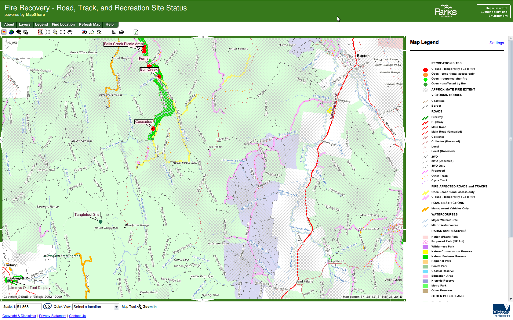
Fire Closures Map in the area between the highway and the hash. The hash itself is just past the closed site 'Bull Creek'.
File history
Click on a date/time to view the file as it appeared at that time.
| Date/Time | Thumbnail | Dimensions | User | Comment | |
|---|---|---|---|---|---|
| current | 13:52, 30 January 2020 | | 1,680 × 1,050 (542 KB) | Maintenance script (talk | contribs) |
- You cannot overwrite this file.
File usage
The following page links to this file: