Difference between revisions of "File:20110913 53-1 01 StartTheWalk.png"
From Geohashing
imported>Monty (Thickwoods Lane, a "Permissive Path" towards the southern end of Langsett Reservoir (there are other ways there, but this is where I decided to park at the end of). The sun is already low in the sky, but there's not far to go, technically. [[Category: M) |
(Maintenance script uploaded File:20110913 53-1 01 StartTheWalk.png) |
(No difference)
| |
Latest revision as of 16:19, 30 January 2020
Thickwoods Lane, a "Permissive Path" towards the southern end of Langsett Reservoir (there are other ways there, but this is where I decided to park at the end of). The sun is already low in the sky, but there's not far to go, technically.
File history
Click on a date/time to view the file as it appeared at that time.
| Date/Time | Thumbnail | Dimensions | User | Comment | |
|---|---|---|---|---|---|
| current | 16:19, 30 January 2020 | 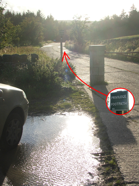 | 480 × 640 (653 KB) | Maintenance script (talk | contribs) |
- You cannot overwrite this file.
File usage
The following page links to this file: