Difference between revisions of "File:20110913 53-1 03 Locality.png"
From Geohashing
imported>Monty (Local signage. Annotated to show the routes driven (in red) and walked (in green) across this particular map's field of view. Category: Meetup on 2011-09-13 Category: Meetup in 53 -1 Category:Signs Category:Ways) |
(Maintenance script uploaded File:20110913 53-1 03 Locality.png) |
(No difference)
| |
Latest revision as of 14:34, 30 January 2020
Local signage. Annotated to show the routes driven (in red) and walked (in green) across this particular map's field of view.
File history
Click on a date/time to view the file as it appeared at that time.
| Date/Time | Thumbnail | Dimensions | User | Comment | |
|---|---|---|---|---|---|
| current | 14:34, 30 January 2020 | 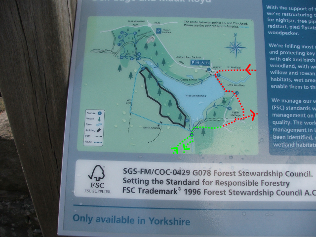 | 640 × 480 (557 KB) | Maintenance script (talk | contribs) |
- You cannot overwrite this file.
File usage
The following page links to this file: