File:20111127N48W123 Tracklog.png
From Geohashing
Revision as of 15:26, 30 January 2020 by Maintenance script (talk | contribs) (Maintenance script uploaded File:20111127N48W123 Tracklog.png)

Size of this preview: 600 × 600 pixels. Other resolutions: 240 × 240 pixels | 688 × 688 pixels.
Original file (688 × 688 pixels, file size: 542 KB, MIME type: image/png)
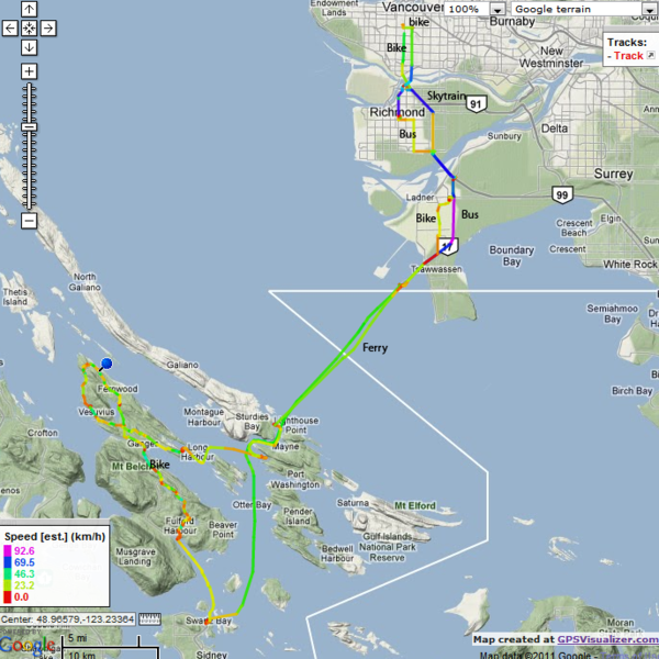
Tracklog showing the trip from 49:-123 to the geohash on Saltspring Island
File history
Click on a date/time to view the file as it appeared at that time.
| Date/Time | Thumbnail | Dimensions | User | Comment | |
|---|---|---|---|---|---|
| current | 15:26, 30 January 2020 | | 688 × 688 (542 KB) | Maintenance script (talk | contribs) |
- You cannot overwrite this file.
File usage
The following page links to this file: