File:2012-05-02 40 -105 hashpoint.JPG
From Geohashing
Revision as of 15:55, 30 January 2020 by Maintenance script (talk | contribs) (Maintenance script uploaded File:2012-05-02 40 -105 hashpoint.JPG)

Size of this preview: 800 × 600 pixels. Other resolutions: 320 × 240 pixels | 912 × 684 pixels.
Original file (912 × 684 pixels, file size: 286 KB, MIME type: image/jpeg)
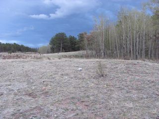
The May 2, 2012 hash point in 40,-105, marked by my Google Maps printout stuck under a rock (the white object on the ground in the center of the image, to the left of the plant).
File history
Click on a date/time to view the file as it appeared at that time.
| Date/Time | Thumbnail | Dimensions | User | Comment | |
|---|---|---|---|---|---|
| current | 15:55, 30 January 2020 | | 912 × 684 (286 KB) | Maintenance script (talk | contribs) |
- You cannot overwrite this file.
File usage
The following page links to this file: