File:2012-10-09 32 -117 18-40-53-978.jpg
From Geohashing
Revision as of 01:40, 10 October 2012 by imported>LucasBrown (Map at the hashpoint [http://www.openstreetmap.org/?lat=32.80637477&lon=-117.13196826&zoom=16&layers=B000FTF @32.8064,-117.1320] Category:Meetup on 2012-10-09 Category:Meetup in 32 -117)
No higher resolution available.
2012-10-09_32_-117_18-40-53-978.jpg (800 × 480 pixels, file size: 121 KB, MIME type: image/jpeg)
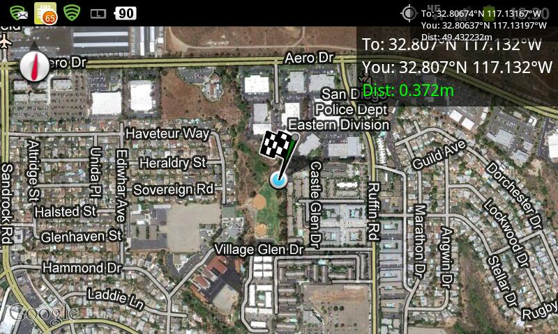
Map at the hashpoint @32.8064,-117.1320
File history
Click on a date/time to view the file as it appeared at that time.
| Date/Time | Thumbnail | Dimensions | User | Comment | |
|---|---|---|---|---|---|
| current | 14:52, 30 January 2020 | | 800 × 480 (121 KB) | Maintenance script (talk | contribs) |
- You cannot overwrite this file.
File usage
The following page links to this file: